On 2nd June, 2022 we set off from Trollstigen Resort at about 7.30 am, after having stripped the bed of the sheets cleaned the kitchen, swept and mopped the floors, as per the instructions given by the Resort.
If doing household chores early in the morning wasn’t enough of a drag, on top of the disappointment of not being able to drive the Trollstigen scenic route, which I had explained earlier was still closed, the weather forecast was of rain all day.
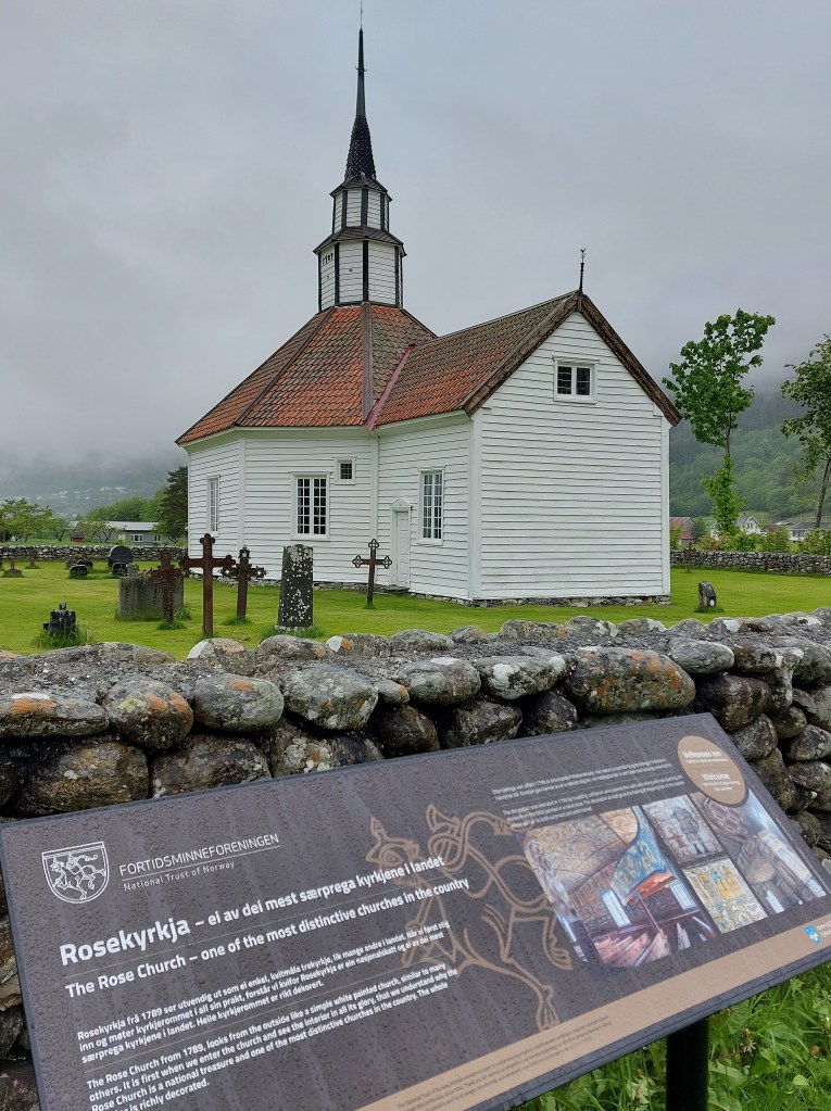
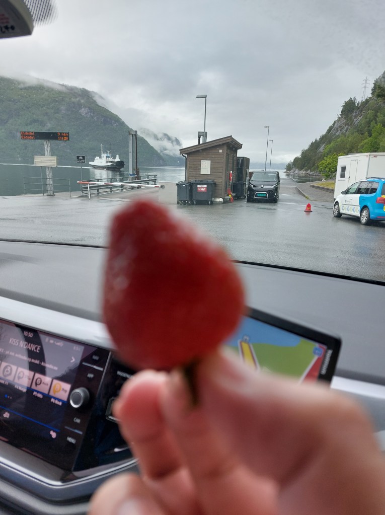
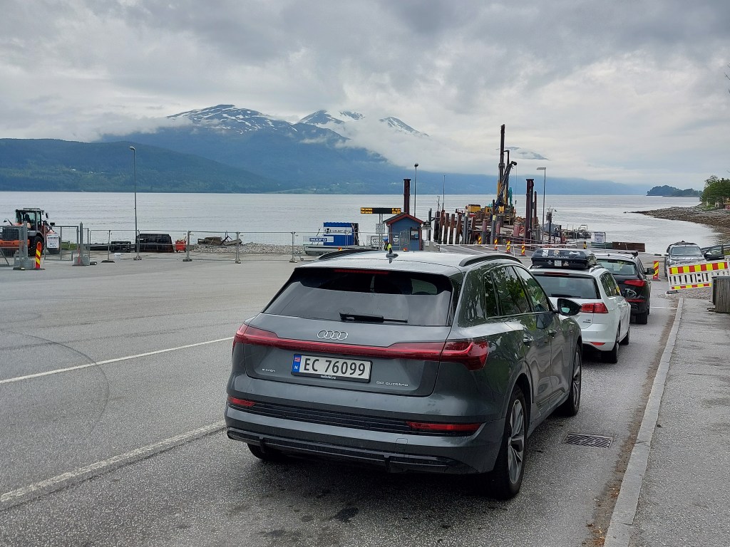
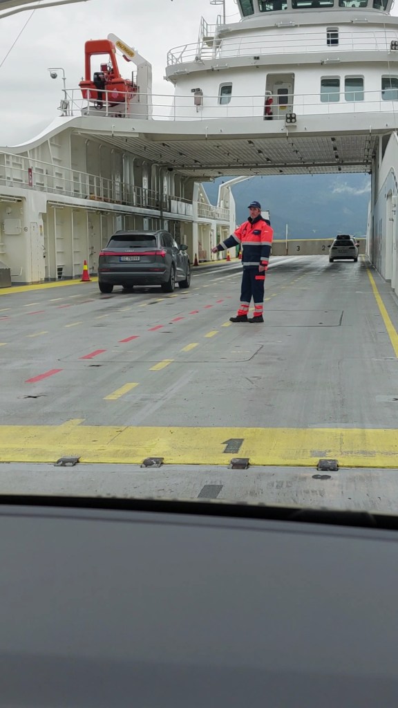
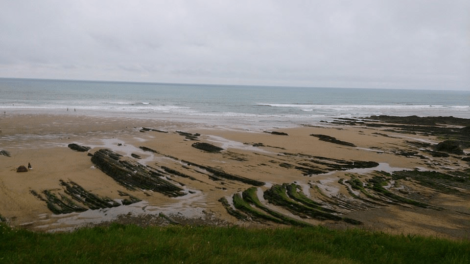
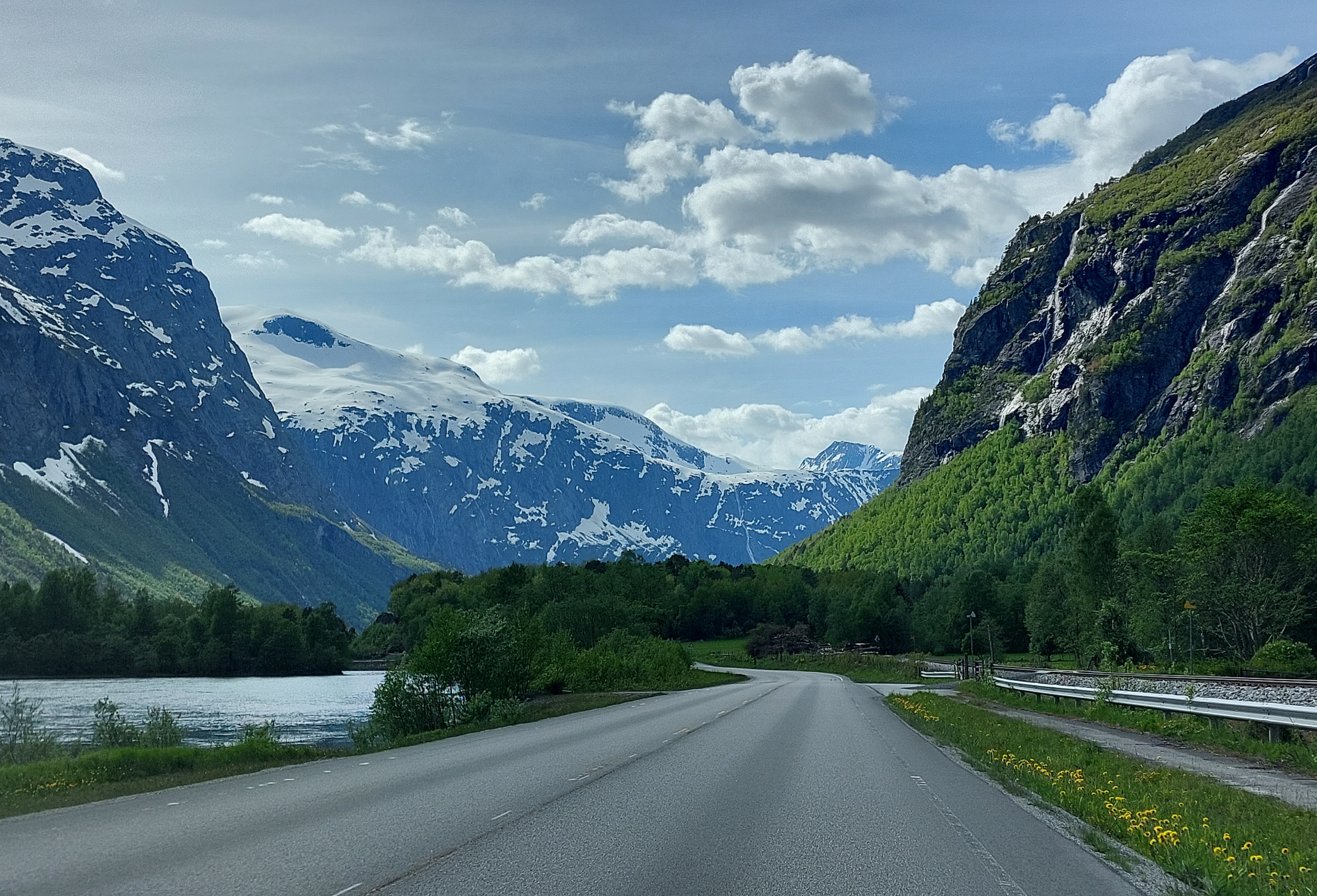
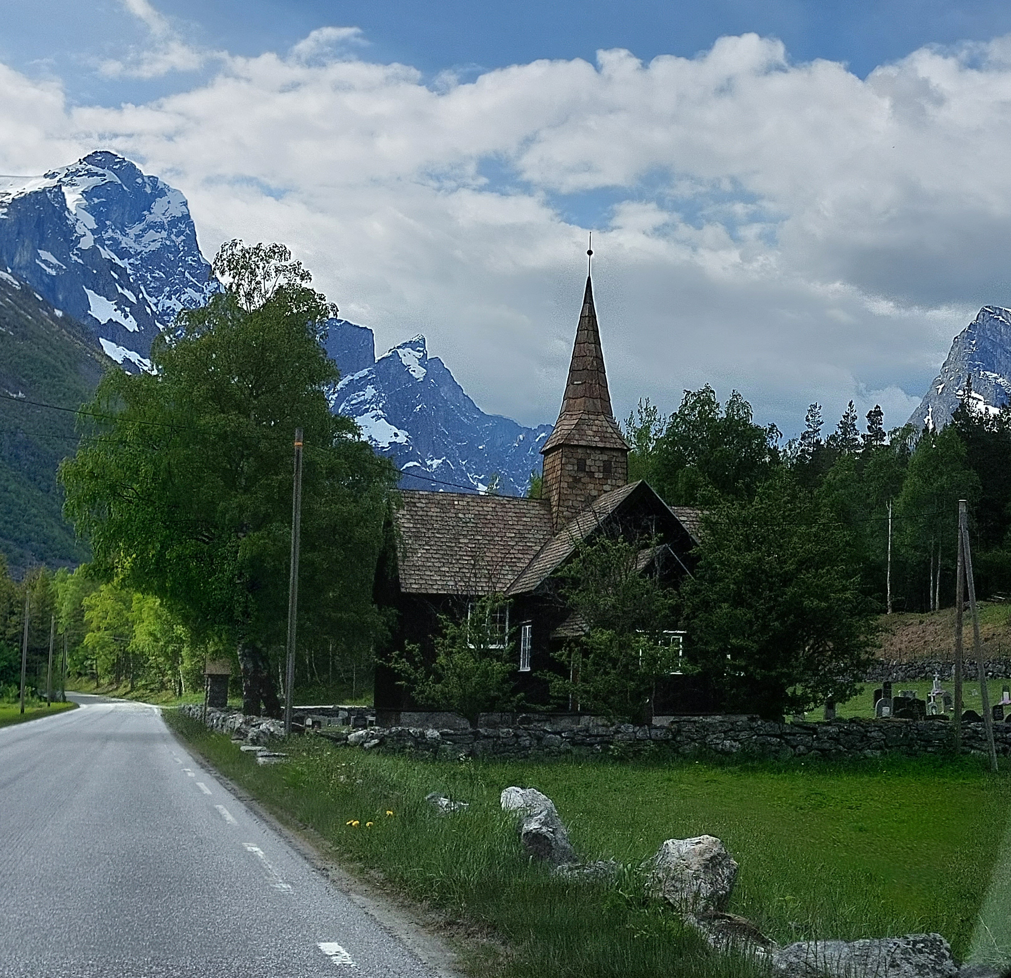
To start off with, we pretty much had similar weather to the day before (see Day 2 -Atlantic Road), it was raining and misty. We took route E136 till after Tresfjord Bridge, then turned left onto E39 and just short of Sjøholtonto, onto Route 650 , we continued on R650. At Stordal we stopped to visit the Rosekyrkja church, but it was closed, so we got to admire it only from the outside. We reached the Linge Ferry Pier on Route 63, to catch the ferry to Eidsdal, this is where Trollstigen scenic would have brought us, but from the east. We were the first in the queue for the next ferry, or as my partner jokingly said last for the previous ferry. While waiting for the ferry, we munched on those delicious Norwegian strawberries, we had bought the day before in Bud. We had a 10 minute wait and then were ushered on. The day had cleared up in the meanwhile, the sun was trying to make an appearance, the crossing took 10 minutes and at Eidsdal being the first one’s to exit we managed to drive into the parking lot of a supermarket than onto the road, so we stopped and bought provisions for the next couple of days, seeing that we had a self-catering accommodation.
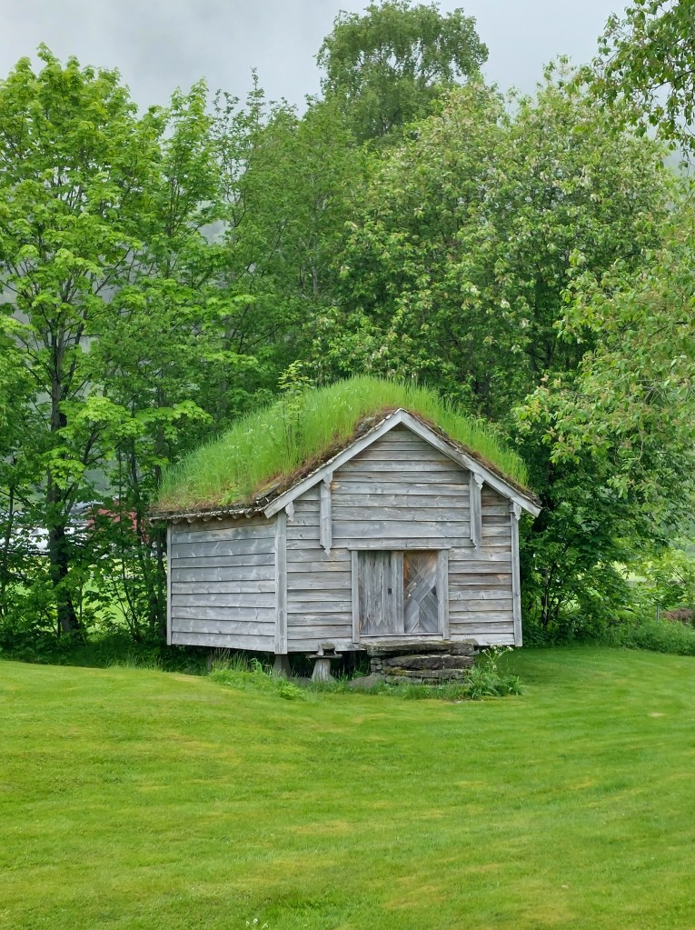
RosekyrkjaGrass Topped HutStraw-Ferry
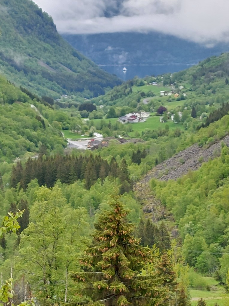
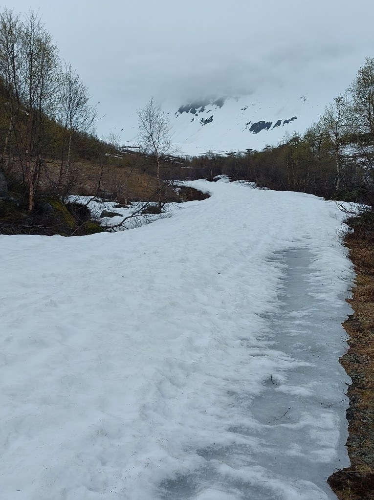
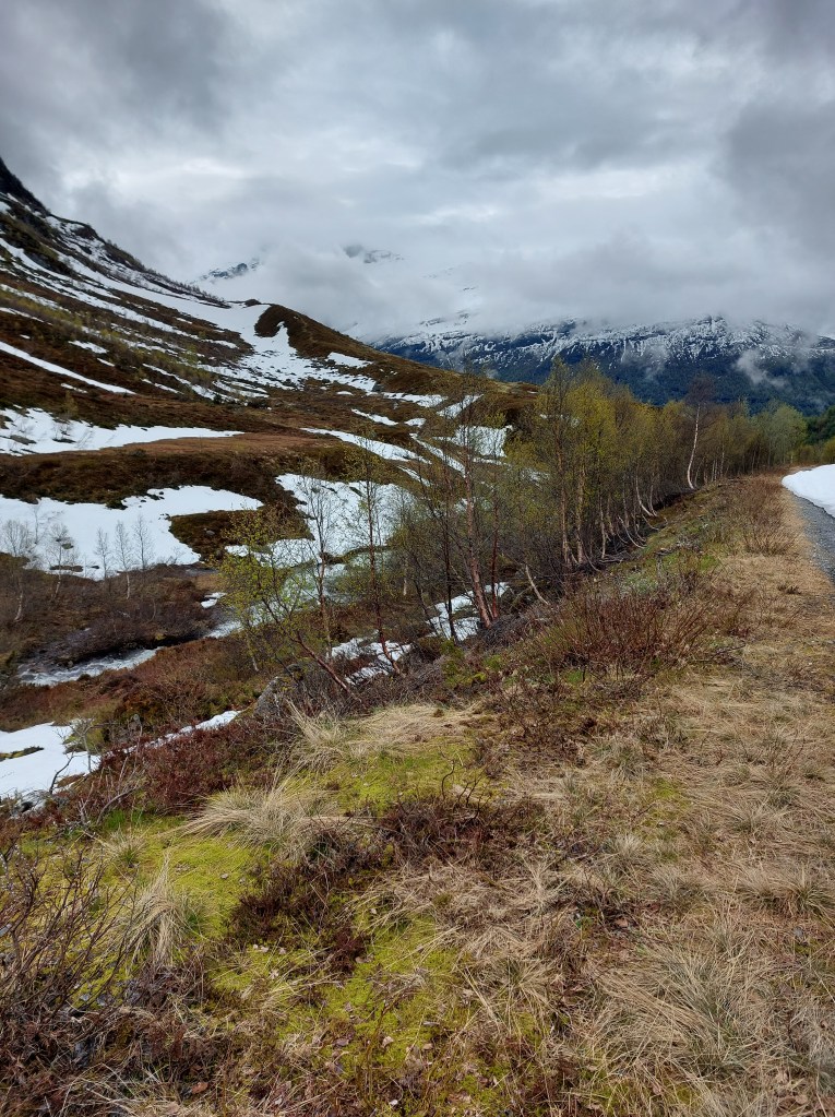
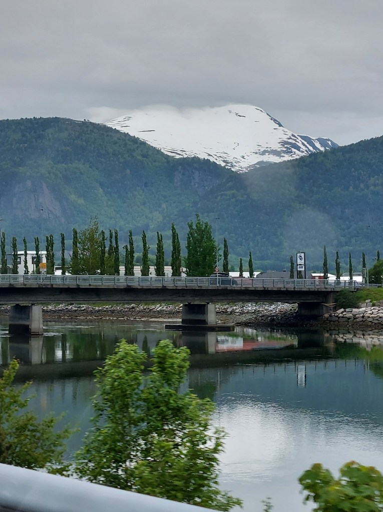
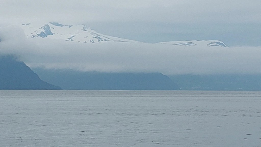
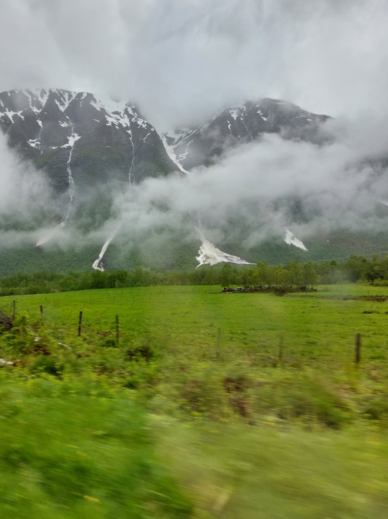
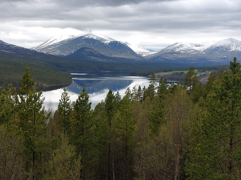
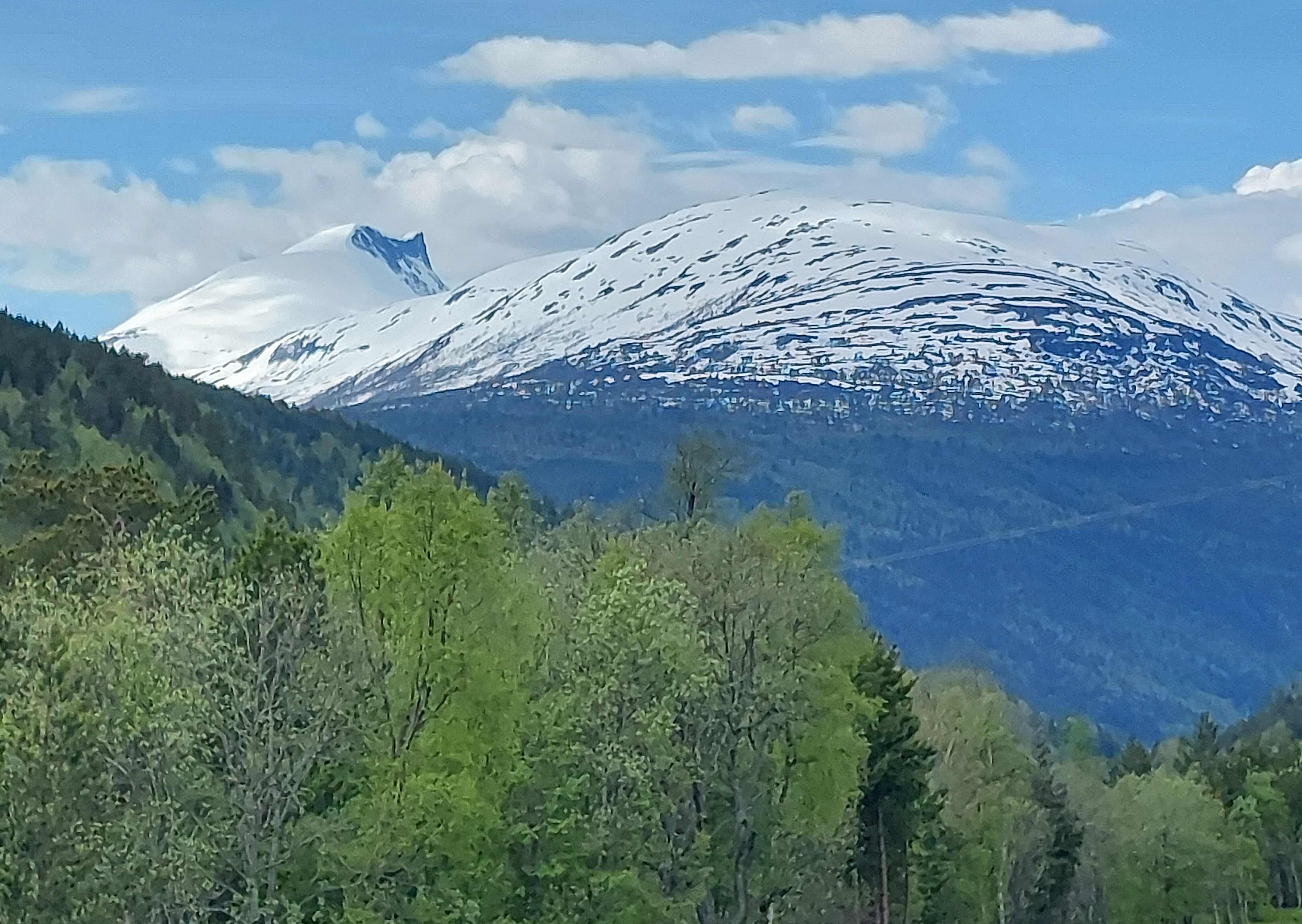
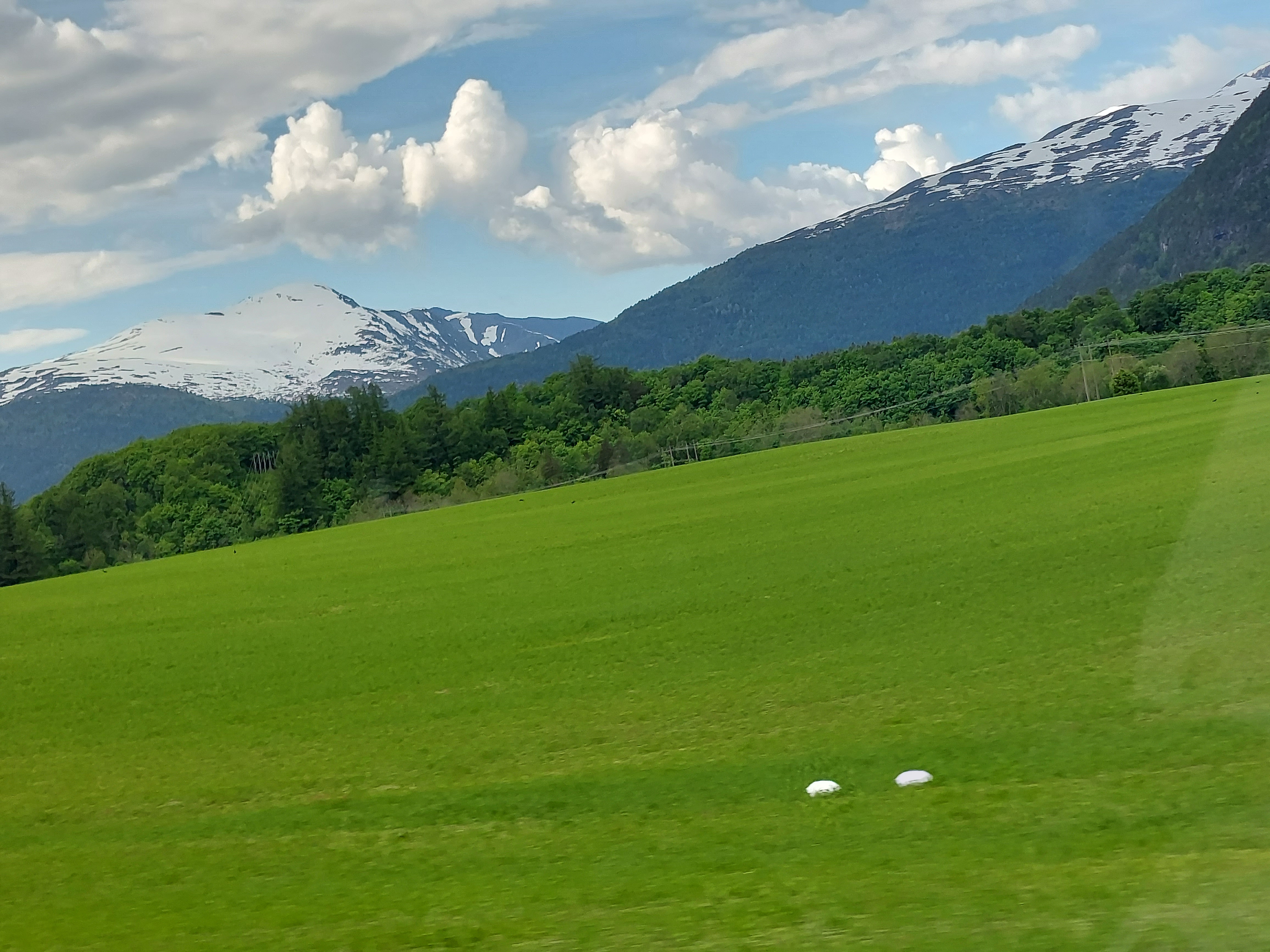
From here the road wound uphill and we stopped to get a glimpse of the view towards where we had crossed the Norddalsfjorden by ferry, it was stunning, Norddalsfjorden is branch off of Storfjorden, just as Geirangerfjord is. We then drove along lake Eidsvatnet and for the first time during this trip came within touching distance of snow. We got our first, and spectacular glimpse of Geirangerfjord from the Korsmyra rest area, which has a huge parking lot, toilets and picnic tables with fantastic views. We had a photo session and chatted with some other travellers. From Korsmyra there are several walking trails and since the day had cleared up, we decided to go for a walk, but we could not go far as the path was covered with snow and we were not wearing the right shoes.
NorddalsfjordenEidsvatnet LakeKorsmyra View and Trails
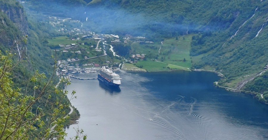
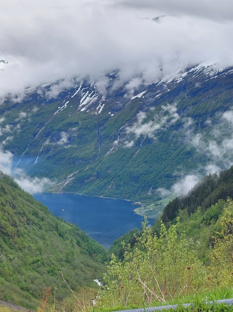
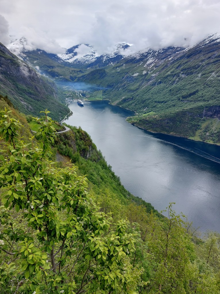
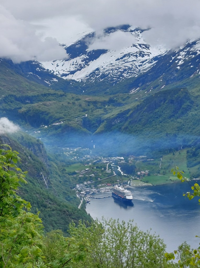
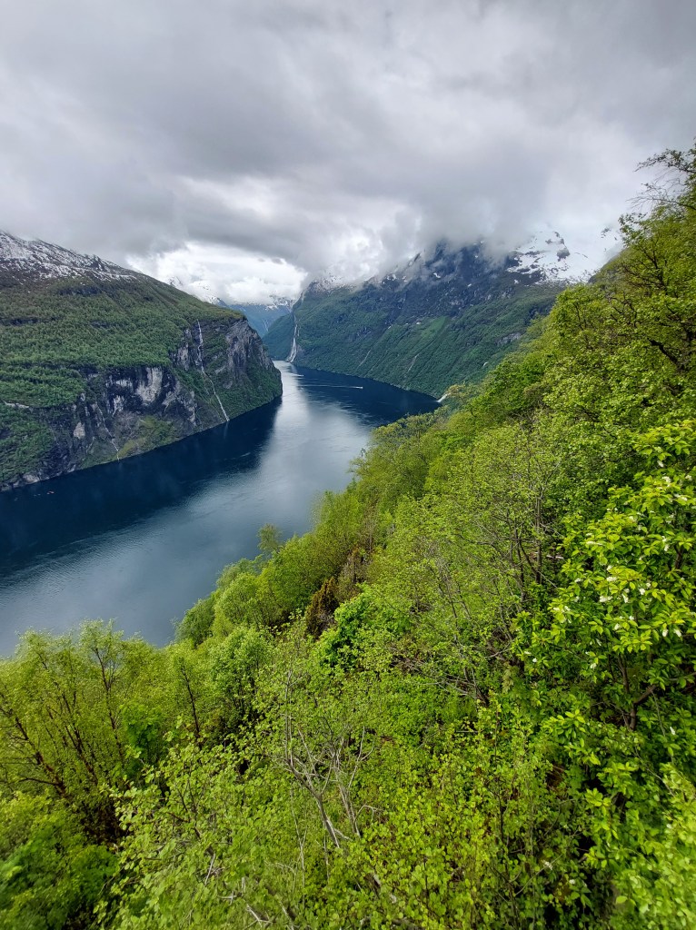
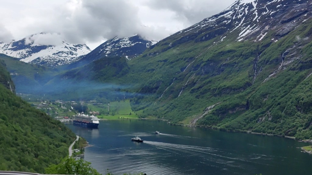
Next stop was the famous viewpoint of Ørnesvingen, an elevated platform overlooking Geiranger fiord from where you can see the Seven Sisters waterfall to the right and Geiranger town to the left. There was a cruise ship docked at Geiranger fiord so we were treated to the iconic view that is synonymous to Norway and on the cover of every travel brochure.
The water was deep blue, the hills were lush green and the Seven Sisters were like strands of Lorelei’s hair. From here the road wound downhill and the view was spellbinding.
Geiranger town itself was like a bit of a contradiction, with not very attractive buildings interspersed with picturesque waterfalls and teeming with people, I presume the cruise ship crowd, one had to drive at snail’s pace, as there were no footpaths and the road had been taken over by them.
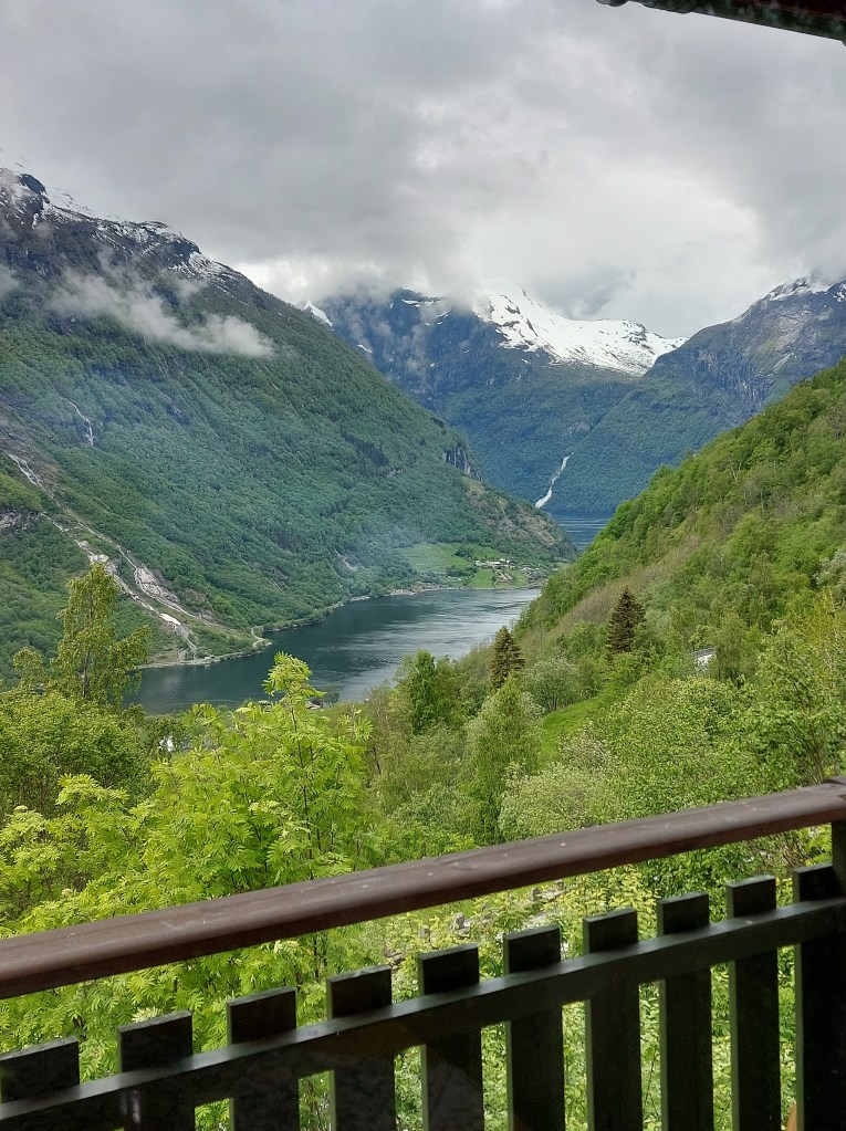
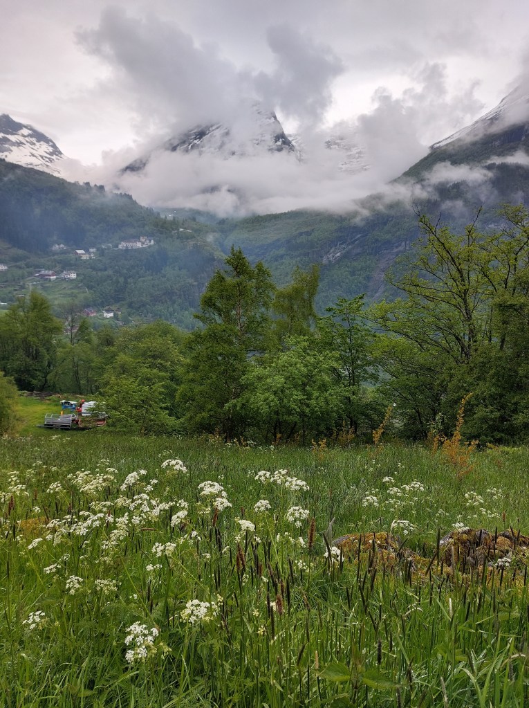
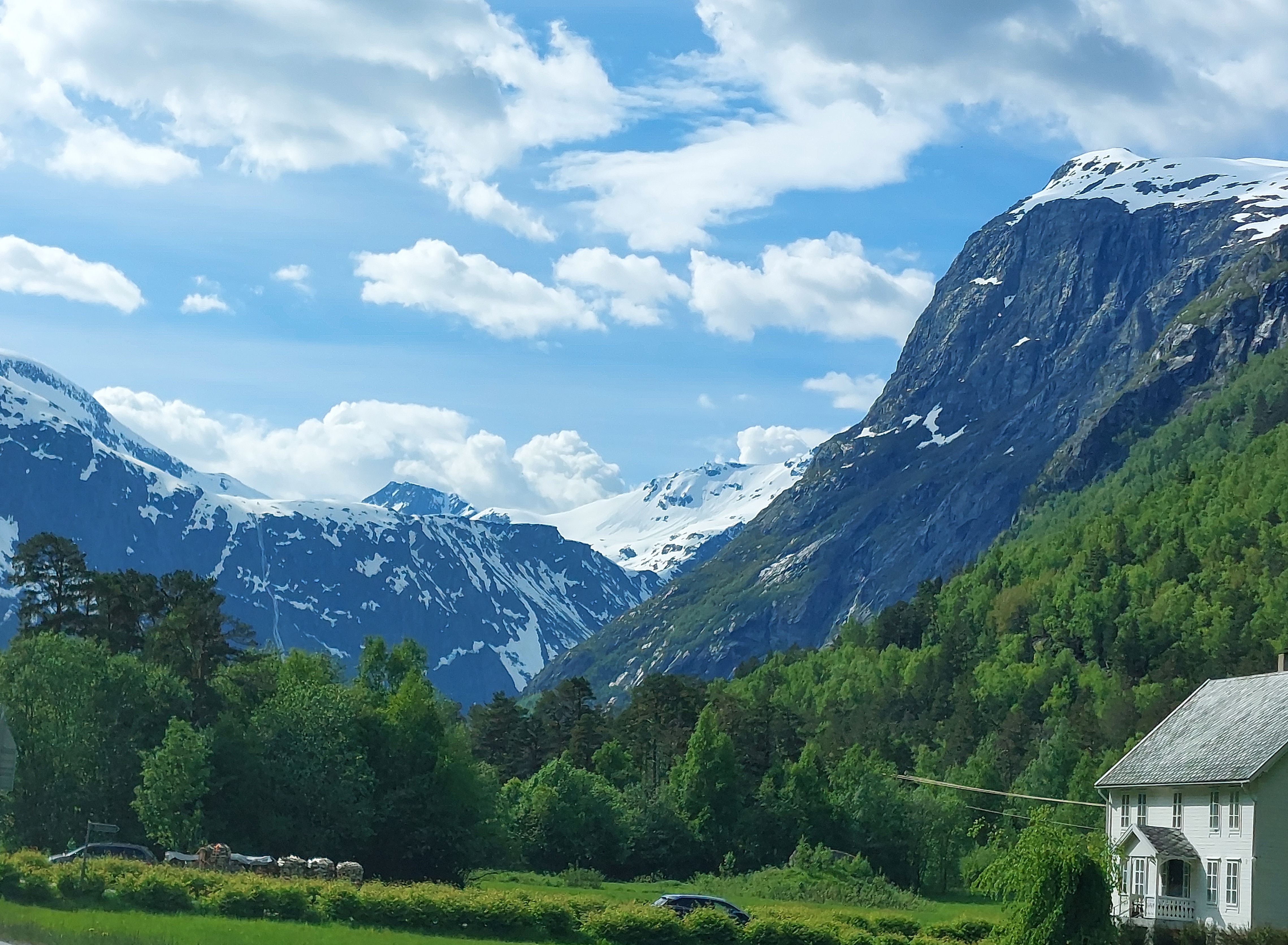
We reached Hole Hytter up on the hill by about 1 pm, our accommodation for the next two days was a cabin with a fantastic view over the waterfalls, Geiranger town and the fiord. The sun was still out so we took advantage of our picnic table and had lunch al fresco surrounded by the beautiful hills and looking down on the fiord.
Hole Hytter Cabins
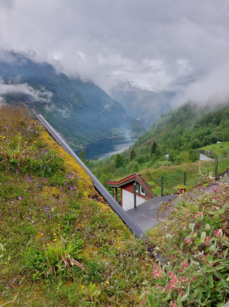
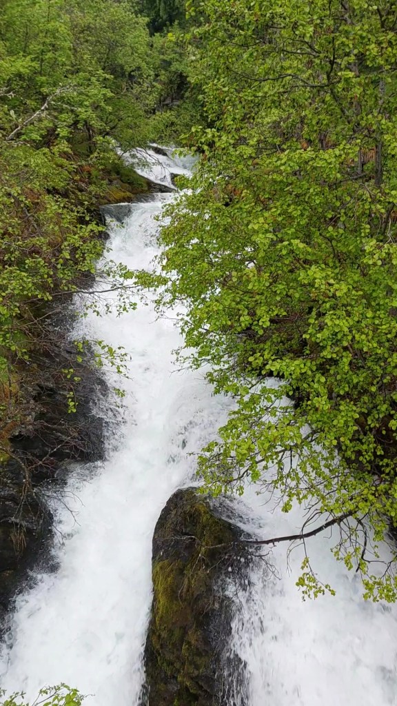
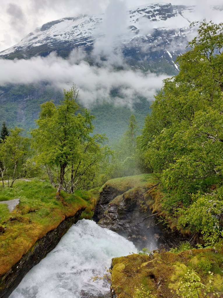
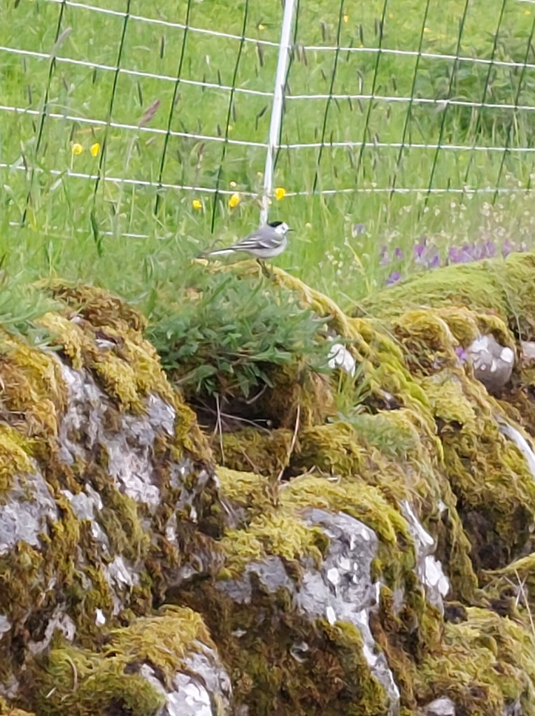
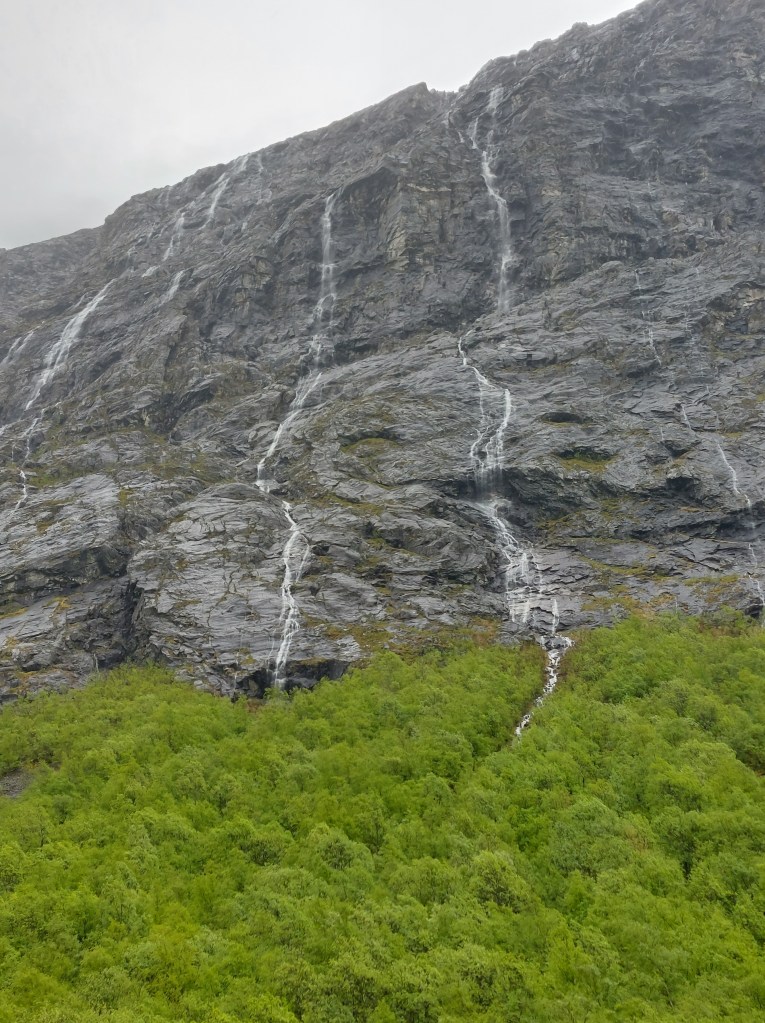
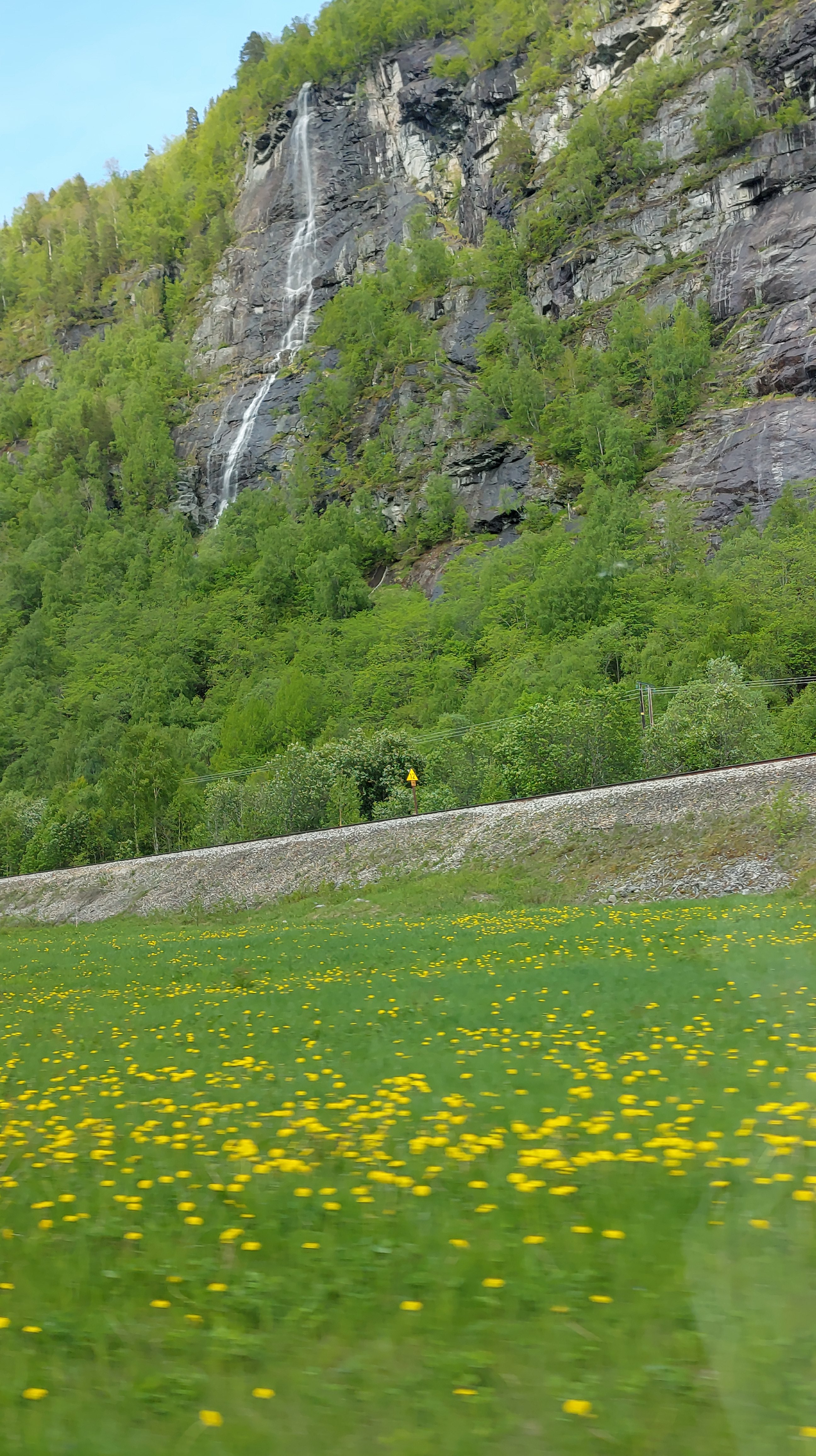
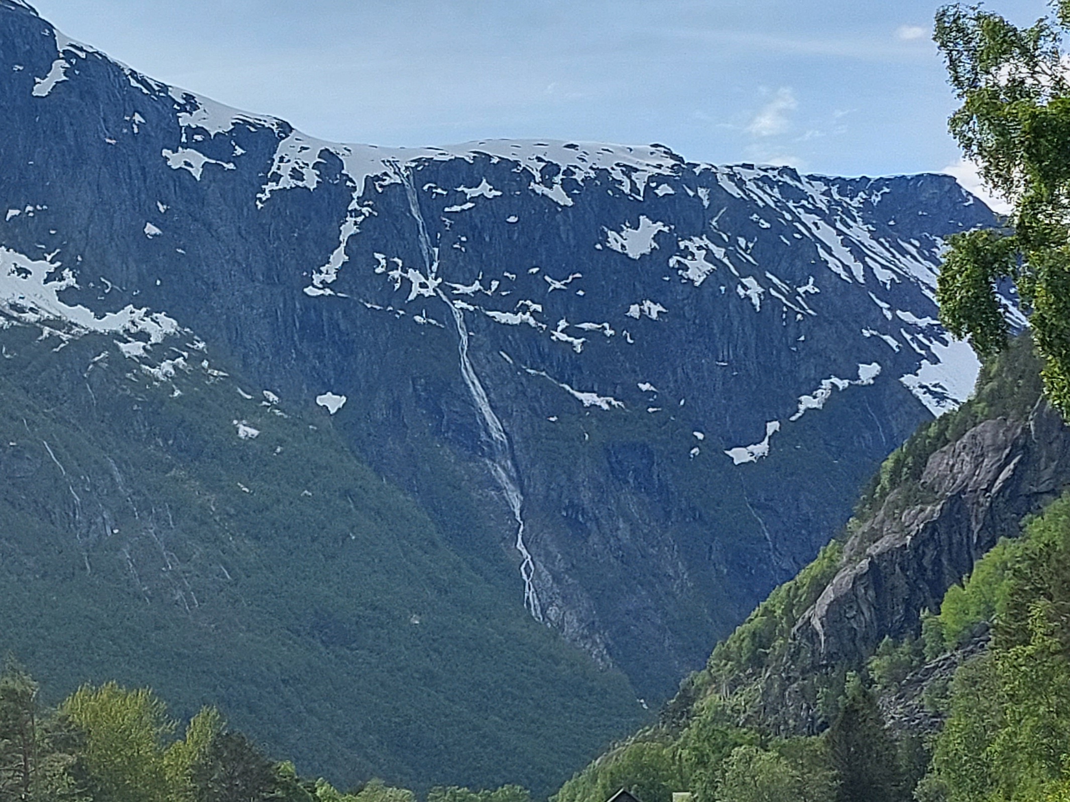
Just as we finished lunch, it started to rain so we sat on our covered balcony, my partner was exhausted and went for a nap, while I went off for a walk in the rain, the cruise ship crowds had dissipated and I had the path all to myself and could stop and admire the Hole waterfall and then the run off from what I think was the Grinddalsfossen waterfall. The wild flowers were lovely, there were sheep on the hills and lots of birds.
Sights from my walk
It was evening by the time I got back and we had a meal of grilled salmon and some stew and went to bed early on our bunk beds, to rest and prepare ourselves for the next day, without the least inkling of the dramatic sights that we were going to behold the next day. Day 4 – Snowballing on Route 63.
Day 2 of the road trip turned out to be a bit of a damp squib, in that, one it was literally damp and two it was decidedly below expectations.
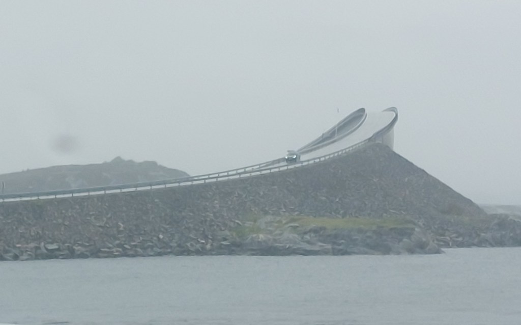
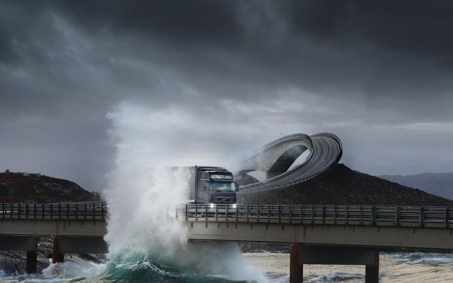
Social media posts have made common, the exciting sight of the Atlantic Road, specifically Storseisundet Bridge with waves from the Atlantic Ocean lashing across it, giving the impression that the cars on the bridge are in danger of being swept away. The bridge is an undulating, cantilevered bridge which looks like a roller coaster track. Every time I saw one of those posts, the Atlantic Road beckoned me, and today was its day of reckoning.
We drove Route 64 through the outskirts of Åndalsnes to Afarnes to make the first ferry crossing of this trip to Molde. This ferry being a part of Route 64 is charged as toll. The Norwegian Public Roads Administration (NPRA) calculates the road toll to be charged when you pass an automated toll station which registers your vehicle’s registration number with a camera and/or reads your toll tag, the same applies for these road ferries. It is to be noted that all ferries are not road ferries and the ones that are not, for eg. the Geiranger Ferry, which I will write about in a couple of days, can be booked online and have to be paid for to the ferry company.
The clouds lay low and the scenery was rain drenched, which gave it an attractive dimension as seen in the photos. All photos on my blog are taken with a mobile phone camera and have no filters.
Route 64 outskirts of Åndalsnes, Norway
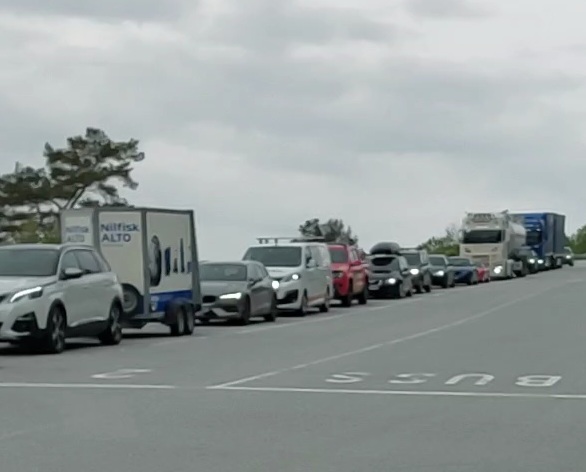
We were nervous about getting things right while getting onto the ferry, but one does not need to be, you simply queue in the lanes which are numbered, so in case it is your first time boarding a ferry and there is not single car before you, just drive to the front of the lane numbered ‘1’. If you reach the queue of cars and your car is going to spill onto the road just head to the top of lane ‘2’ and wait patiently, the staff present at the dock will indicate when and where you have to drive onto the ferry.The ferry boarded, my partner was reluctant to leave the car, not knowing the etiquette, since this particular crossing takes 15 minutes and I wanted to see the view, I jumped out and asked one of the staff, if I could go to the upper deck, there is no view from the lower deck unless you are seven feet tall. He was so kind, he actually took me up in the lift, there was a café and toilets and a deck. The toilets on the ferry were spotlessly clean so I went back to the car and cajoled my partner out of the car on this pretext. We were lucky, it had stopped raining though the clouds were still hanging low. The view from the ferry on bright and clear days must be spectacular but we felt so spectacular ourselves that we had no complaints. While exiting the ferry, you have to be careful to change lanes and get into the lane on the far-right as the lanes for getting onto the ferry are to the left.
WaitingBoardingDeboardingView from FerryView from Ferry
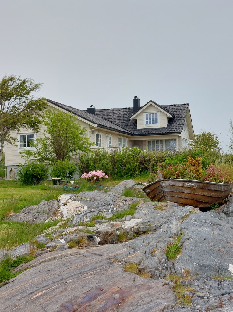
From Molde we drove on to Bud, the town that we had decided to visit. I had read that it was very pretty and it being smaller than Andalsnes and Molde would also be easier to enter and park in. We avoid big towns for a couple of reasons, we do not enjoy densely populated areas, preferring isolated spots with natural beauty and do not want the headache of navigating town traffic and finding parking and then wasting time in figuring out how the parking has to be paid for, only to subsequently stress over whether we had done everything correctly. The other attraction of Bud which is pronounced bude was our affection for its namesake town in Devon, UK – Bude which is also on the sea and which remains in the limelight of our memories.
Bude, Devon, England
The Germans who occupied parts of Norway during WW2 built Ergan Fortress here expecting an invasion by the Allied Forces. The invasion never happened. However, there are many bunkers, gunneries, and position establishments still maintained here. The Ergan Coastal Fort is now a part of the Bud Coastal Museum, which is a war memorial museum. Ergan also has exceptional views over the fishing village of Bud and the waters of Hustadvika.
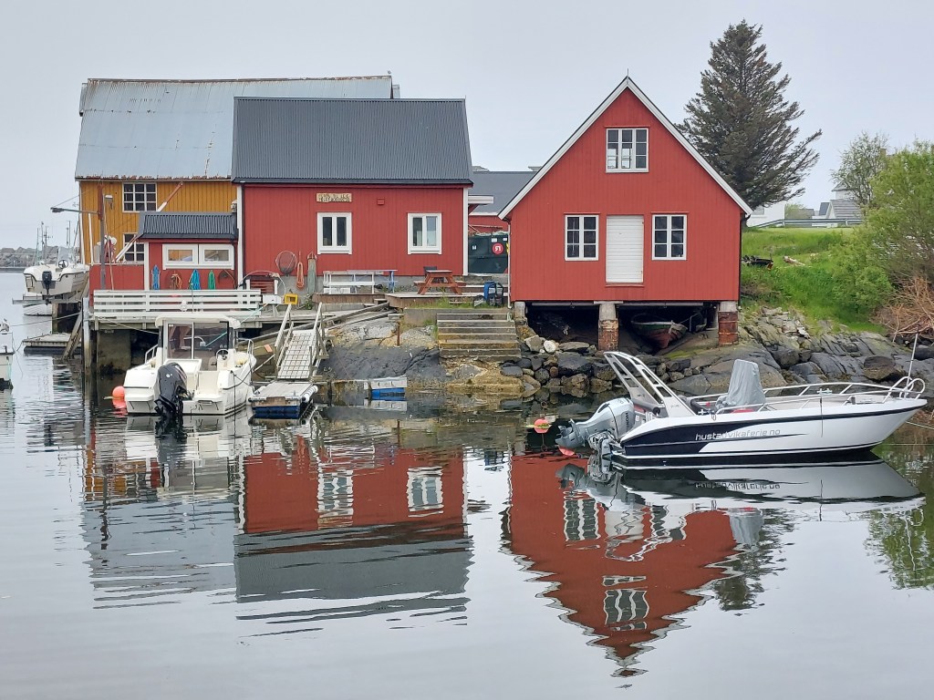
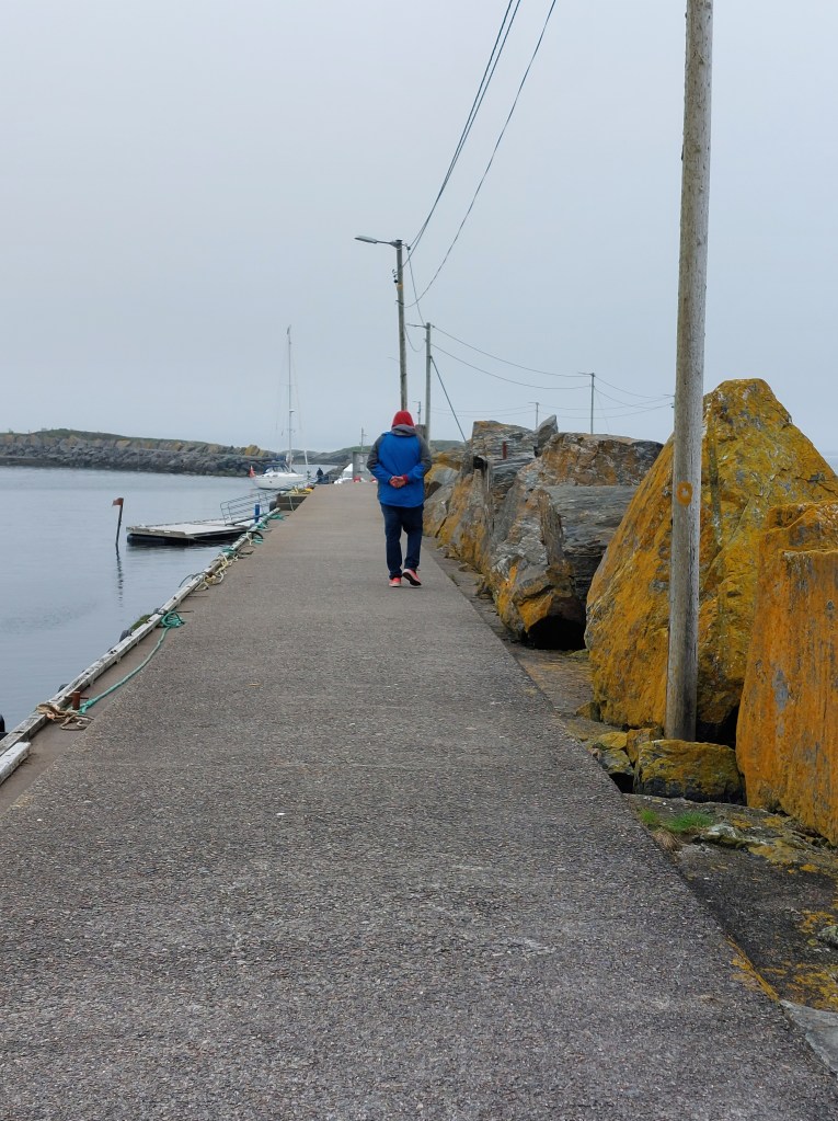
In Bude we parked in what we realised later was the local school parking and wandered around the town, it was not even 10am, the town was quiet, just a couple of girlfriends jogging and chatting and a smattering of tourists like us getting the measure of the place. We found our way to the water’s edge and walked along the pier. Seagulls were about, the houses were very pretty, brightly coloured with gardens full of flowers. It started raining again and as we could not find a place to catch a coffee or a bite, and accessing the bunkers in the rain was not possible, we made our way to the supermarket and bought ourselves some fruit and headed to our car.
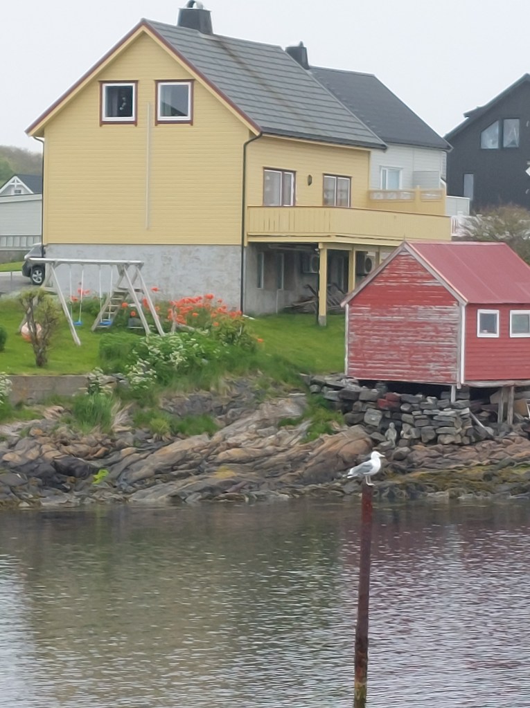
Bud, Norway
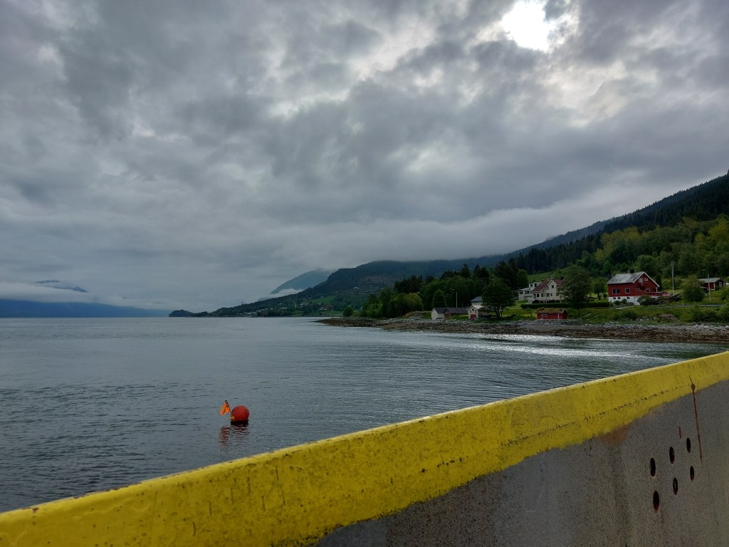
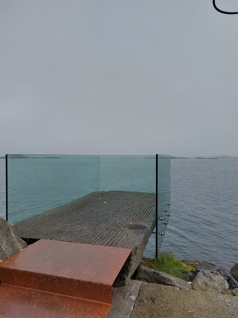
While driving from Bud in the direction of the Storseisundet Bridge we made a two-kilometre detour to see the Askevågen Viewpoint, which has a platform with glass walls, located at the end of the breakwater, that provides a 360-degree view of the ocean, the archipelago and the mountainous shore. This stop was both scenic and instructive as the information board provided in interesting detail the origin of the name Askevågen – literally Ash Bay. It seems Kelp was gathered and laid out on bare rocks to dry, and later burnt in stone kilns that were built along the beach. Ashes from the burning of kelp were an important ingredient in the production of soda, which was used in the manufacture of glass and other things. The demand for kelp was great, and kelp burning thus became an important livelihood for many coastal families. Since animal feed was a scarce resource, seaweed and kelp were used as food for the livestock. Kelp could also be used to improve the soil in the fields. Kelp burning gradually became such an extensive activity that many people believed it was detrimental to fishing. Thus in 1804 kelp burning was made illegal. In the 1870s there was growing demand, and burning was resumed. Now the ashes were used to tract iodine, which was important in medicine. The iodine content in kelp is highest at northern latitudes and it was therefore more valuable than kelp from Southern Europe: Kelp burning came to an end in 1930 due to the discovery of simpler and cheaper methods to produce iodine. Even today, sea kelp is an important product because of its high level of nutrients.
Askevågen Viewpoint
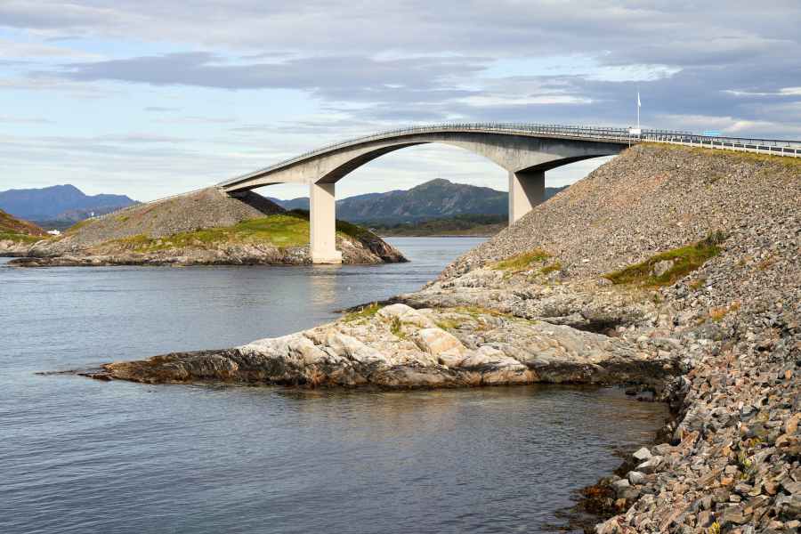
The day continued to be dull and drizzly we approached the famous Storseisundet Bridge in Averøy Municipality. Waves did not lap across it, we were in no danger of being swept away and though it looked like a roller coaster, it did not feel like one. All in all, it was more than a bit of an anti-climax. Looked interesting, but didn’t live up to my expectations in its navigation. I guess all the photos that I had seen of the Atlantic Road had been either taken aerially and / or enhanched, what I saw from the gound just did not match up.
Atlantic RoadStorseisundet Bridge
Unphased, we stopped at the Eldhuset – Atlanterhavsveien Kafe next to the bridge and had an early lunch of some hearty Thai soup, defrosted and served to us by a friendly Polish lady. We met lots of Polish people in Norway, which seemed providential since we were headed to Poland after the Norway road trip. After lunch we drove along the Atlantic Road till Karvag and the weather just kept getting worse, with very little visible through the rain drenched windows of the car and the fog so we decided to abandon our plan to drive to Averøy and then Kristiansund and headed back to Trollstigen Resort.
Jet lag caught up with us and just as we reached Elde we were both finding it hard to keep our eyes open, so just as we have done on earlier road trips, to avoid the possibility of a sleep related driving incident, we stopped in lay-by along Route 64 and took our forty winks, refreshed from our nap we continued to our resort.
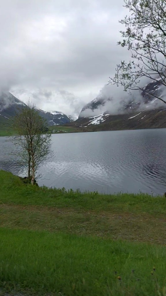
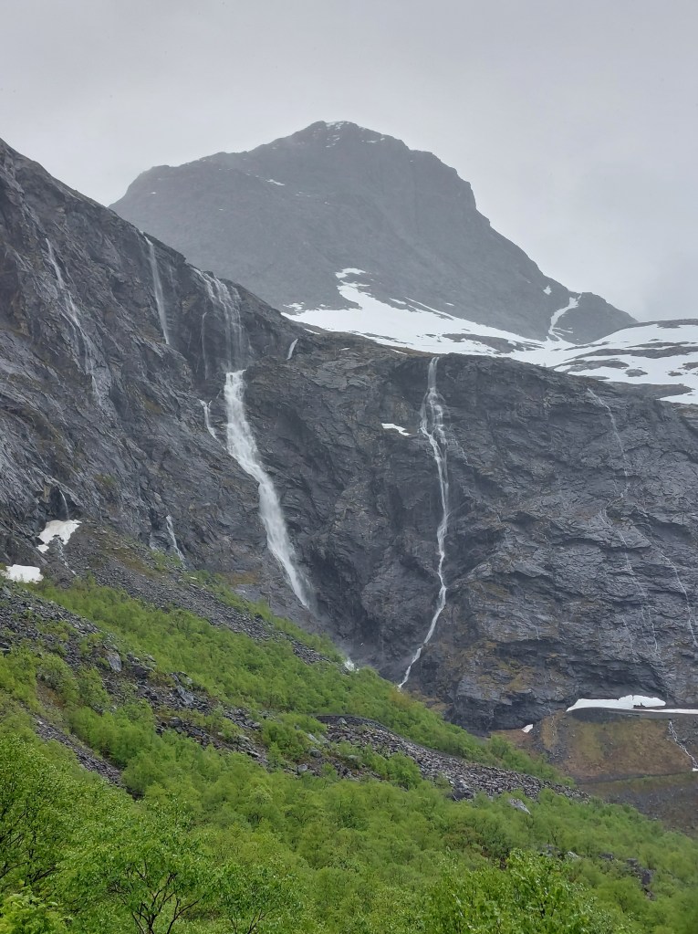
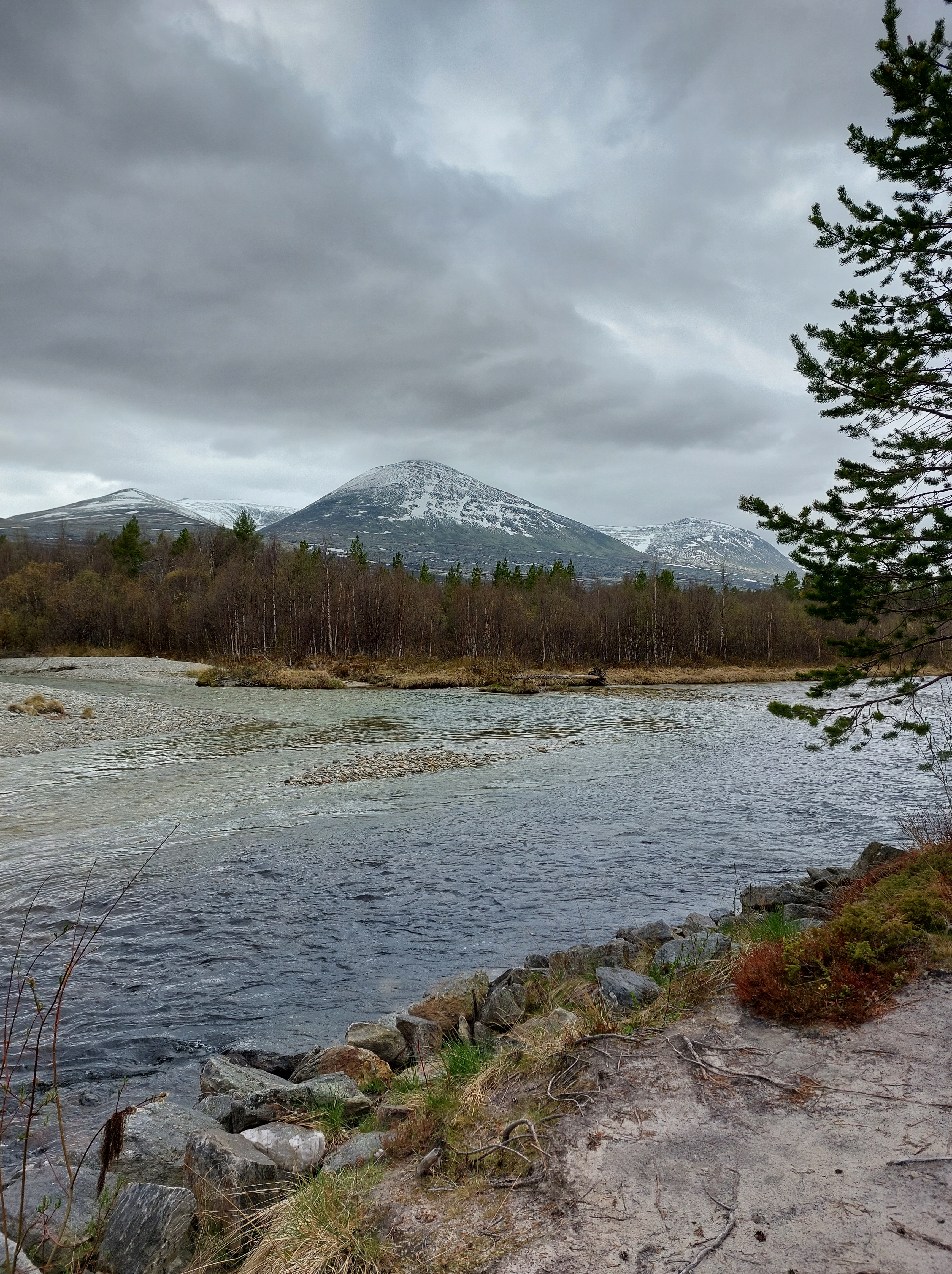
Once we reached the resort, we had a quick refreshment and headed towards Trollstigen, we drove some 8 kms to the Information Viewpoint, it was raining steadily but the drive was beautiful, milky blue glacier waters ran along with us and the viewpoint was in a valley with hundreds of waterfalls sliding down the slopes and we could see the famous winding Trollstigen Road going up the face of the mountain. As described in Day 1, we had planned to drive the Road towards Geiranger on Day 3, but due to avalanches in the winter the road was not yet cleared and open, so this is as far as we were going to get. We met a Dutch family at the viewpoint who were in the same predicament as us and the rain notwithstanding we huddled in our raincoats and chatted about our itineraries.
Drive to Trollstigen Information Viewpoint and the view from there
On returning to the resort, we had grilled salmon with accompaniments for dinner, put together by us in our cabin. Later, the Norwegian lady we had met the day before joined us over fresh strawberries and coffee to chat, into late in the evening, about life and travel in our respective countries. We retired for the night, already excited about the sights we would see enroute to Geiranger fiord, the next day – Day 3 Trollstigen to Geiranger Fiord.
Over my next few posts, I am going to relive a 12 day road trip that my partner and I undertook across Fjord Norway from 31st May 2022 to 11th June, 2022. The hiatus that the pandemic brought international travel meant that this vacation was more anticipated than any before and after having been cooped up at home for the most part of two years, Norway was the perfect panacea, giving one ample opportunity to feast one’s eyes on wide expanses of blue sky.
We arrived at Oslo Gardermoen Airport, on the evening of 30th May, 2022. As the plane started its descent, I looked down, at the lush green countryside, interspersed with pools and streams of crystal clear water with the clouds reflected in them, and thought, with awe and conviction, that I was looking down at god’s own golf course. We had elected to come just before tourist season which commences around the 15th of June, in the hope that we get to enjoy the sights in peace and avoid crowds and hence reduce the likelihood of contracting, you know what. This call would turn out, mostly to be a boon.
On landing, luggage retrieval was quick and hassle free. We headed to the airport currency exchange to get ourselves some Norwegian Krone (NOK, one US$ is equivalent to roughly 10 NOK), however it was about 7pm and the counter was closed. Later, at the rental car desk, we were told that the exchange had shut shop a few days back, they told us not to worry, as cards are accepted universally in Norway, this bore true, in fact, there are establishments in Norway that do not accept cash, not vice versa. The rental car desks were clearly signposted and we completed the formalities of signing the rental contract and taking the comprehensive insurance cover within minutes. The car had been booked in advance through Economy Car Rentals, it was a grey VW Polo provided by Europcar. Our own TomTom, satellite navigation system (satnav) installed, we nervously made to ease out of the underground rental car parking. This is always a stressful process, as the satnav cannot receive signal in the underground parking and having been turned on for the first time in a new destination is unable to provide directions. Anyway, before we could exit, we turned back as the fuel gauge appeared to show the tank as empty, the ‘0’ was red, it was supposed to be full, so I clicked a photo and rushed back to the rental desk, while my partner waited in the designated parking of Europcar. I was assured that the tank was full, I needed to see the points to the right of the ‘0’, the vertical dashes to the right of the number gauge, which were going right to the top to indicate that the tank was full. Reassurance gained, we once again nervously headed towards the exit, floundered as we reached the open to get our bearings and to ensure that we were driving on the right side of the road. The satnav still had not found its signal, nor had the cell phone, so we had no option but to take the motorway and hope we were headed in the right direction. It was by now 8.30 pm, but being in the land of the midnight sun we had the advantage of getting our bearings in broad daylight. Our destination the Best Western Leto Arena Hotel, booked for its proximity to the Airport, 12 kms north of it, just off the E6 highway which we would be taking further north the next morning to get to Åndalsnes. Fortunately, we had exited the Airport in the right direction and soon reached our halt for the night. Do not miss out on reading about our misadventure in getting the car back to the rental car parking when we return to the Airport in the last of this series of posts.
Even though the hotel was surrounded by concrete, the bright blue sky where the odd fluffy white cloud hung ornamentally, the verdant treeline beyond the concrete and the brightly coloured homestead across the road gave us a titillating glimpse of what was in store for us and we couldn’t help but jump for joy. The excitement of being in Norway for this road trip, which had originally been planned for May – June 2020, the seeping in of the belief that life could go back to pre-pandemic mode and our liberation from masks, which were still the norm at home, gave us a heady feeling and a robust appetite.
Check-in was painless, the receptionist was pleasant and friendly, she informed us that dinner was a buffet consisting of meatballs, sides, salads and dessert, she said the meatballs she had made herself and they were delicious, not that we needed any convincing. We enjoyed our dinner and prided ourself on our restraint in not partaking of the delectable desserts on offer, as we are following a regime of not eating sweets in the evening. After dinner we took a couple of rounds of the car park and headed off to bed to be ready for our early start the next day.
The next day Tuesday the 31st of May, 2022, our road trip officially began. Sleep for me was fitful, I joked that my lungs are too used to polluted air and the clean air was proving too much for them to take, by 3 am it was already day outside, I checked the routes we were to take and weather conditions etc. We were ready, and at the breakfast buffet by 6.30 am. The buffet was varied and bountiful. Here started our breakfast saga of smoked salmon, having platefuls of it served for breakfast makes you truly feel you are in Norway.
By 7.15 am we had checked out and were on our way to Åndalsnes some 430 kms north-west. Driving in Norway is pretty simple, the maximum speed limit is never above 80 kms per hour and most people honour the speed limit, most roads, even the highways, have just one lane, in each direction, interspersed with sections for overtaking, but with the speed limit being so low only those, who are ready to brave a speeding ticket, overtake. The one thing you should be prepared for are the tunnels, every route that we drove had tunnels, and some really long ones, the longest in Norway being 25 kms. This is probably one of the reasons that in Norway all vehicles must have their headlights on at all times, when in motion, regardless of the time of day or time of year. This also means you need to be careful about wearing sunglasses as tunnels come upon you without warning and you could be plunged into darkness. If you are not used to tunnels, as we were not, they require concentration, they tend to get hypnotic and give you the feeling that you are on a conveyor belt in a stationary car and don’t need to control the vehicle.
It was overcast but the scenery was already stunning, we were driving along the E6 with a large expanse of water to our left, it seemed to be the sea but we were in central Norway, so it couldn’t be, could it? I checked and discovered that the water body was in fact Mjøsa, Norway‘s largest lake. Rest places along the E6, for taking a toilet stop were well indicated, the toilets were clean and the settings scenic, with picnic tables and even the possibility of taking a little walk, as I did at one
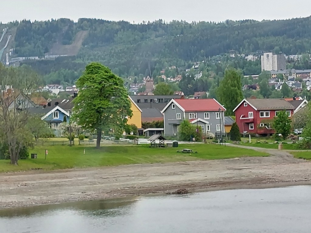
After driving along lake Mjøsa for some 100 kms we crossed it and entered the former county of Oppland, the area now a part of Innlandlet, stopping at its pretty information viewpoint, the lake now to our right. The highway from here had just single lanes each way, we crossed Lillehammer, the venue for the 1994 Winter Olympics and I could see the ski slopes, now bare of snow.
Lillehammer
We were by now super excited as our next stop would be in Rondane National Park, the oldest National Park of Norway. I had been hell bent on not taking the highway all the way, though in hindsight, Norwegian highways are no less picturesque. My research had led me to the possibility of taking Route 27 from a little ahead of Ringebu on the E6 in the direction of Folldal effectively driving Rondane, one of the 18 Norwegian Scenic Routes, through the National Park. I found the Visit Norway website an excellent resource to gather information about all things concerning travel in Norway. It sends you automatically to the relevant websites, for example, if you are searching scenic routes, it will send you to the Nasjonale Turistveger website. Another useful resource to keep abreast scenic route openings and temporary closures etc. is the Norwegian Scenic Routes facebook page.
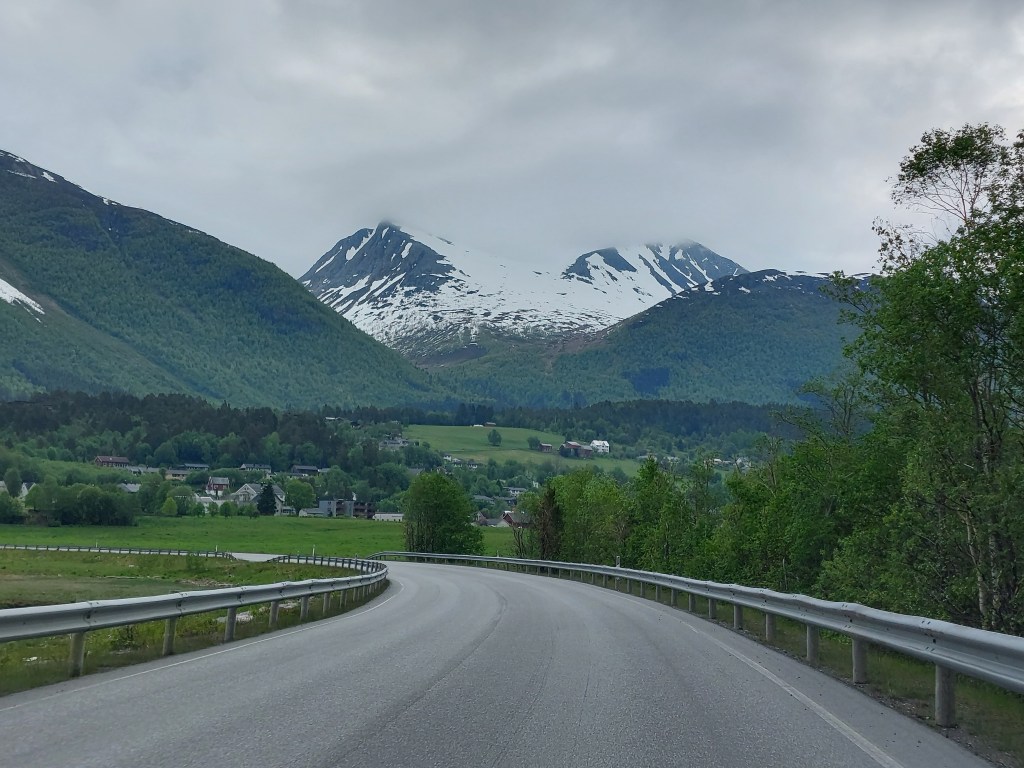
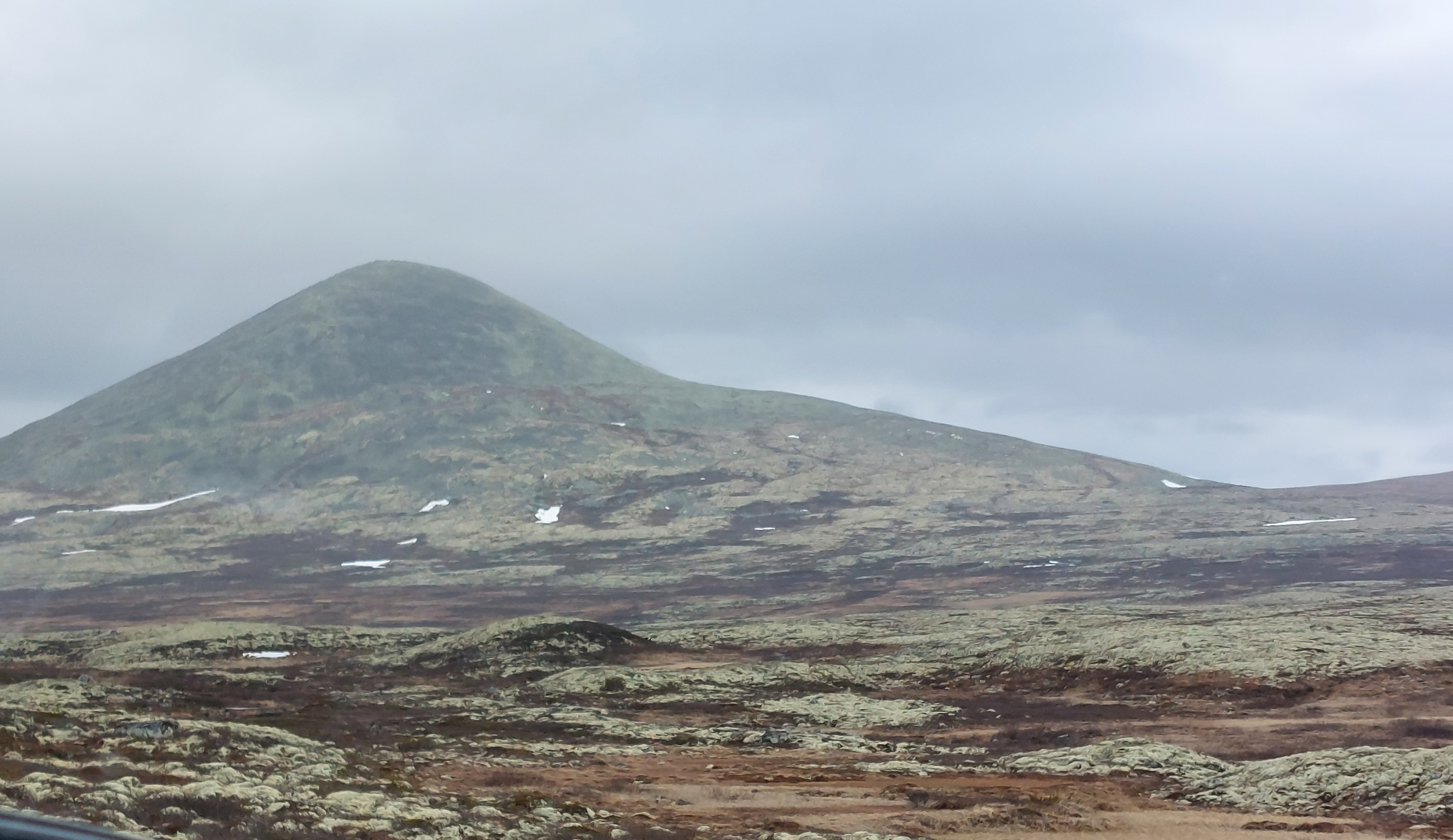
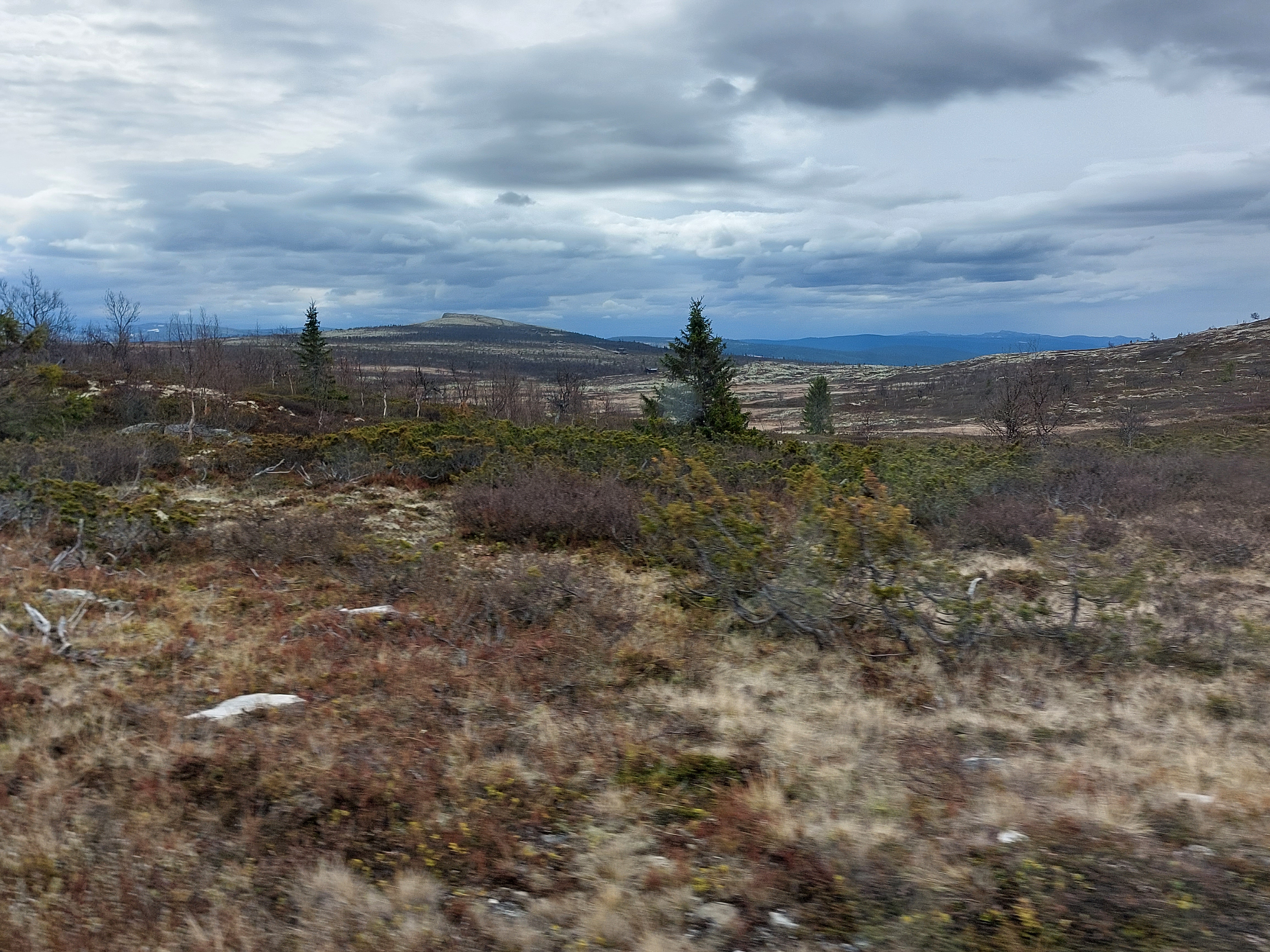
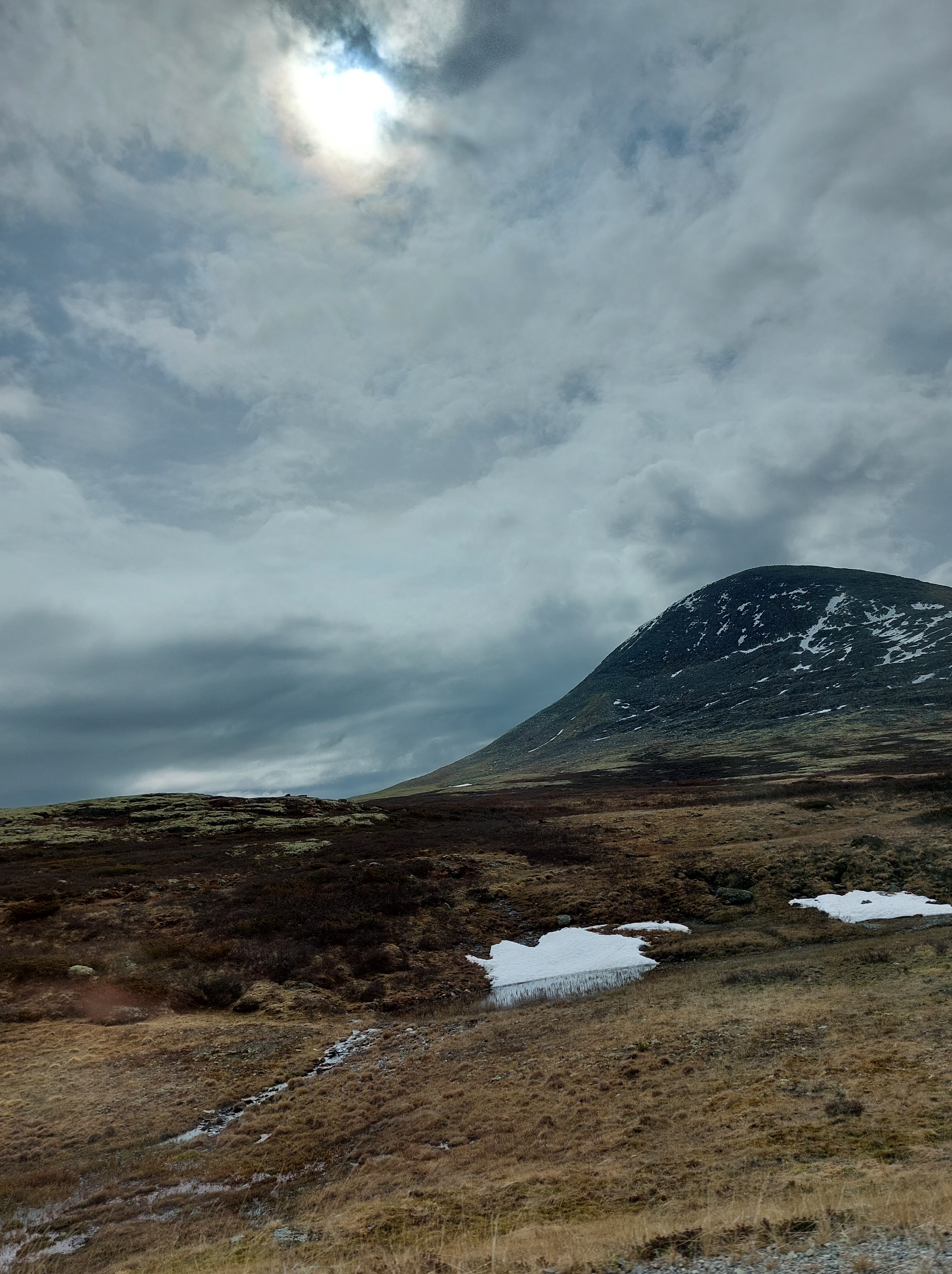
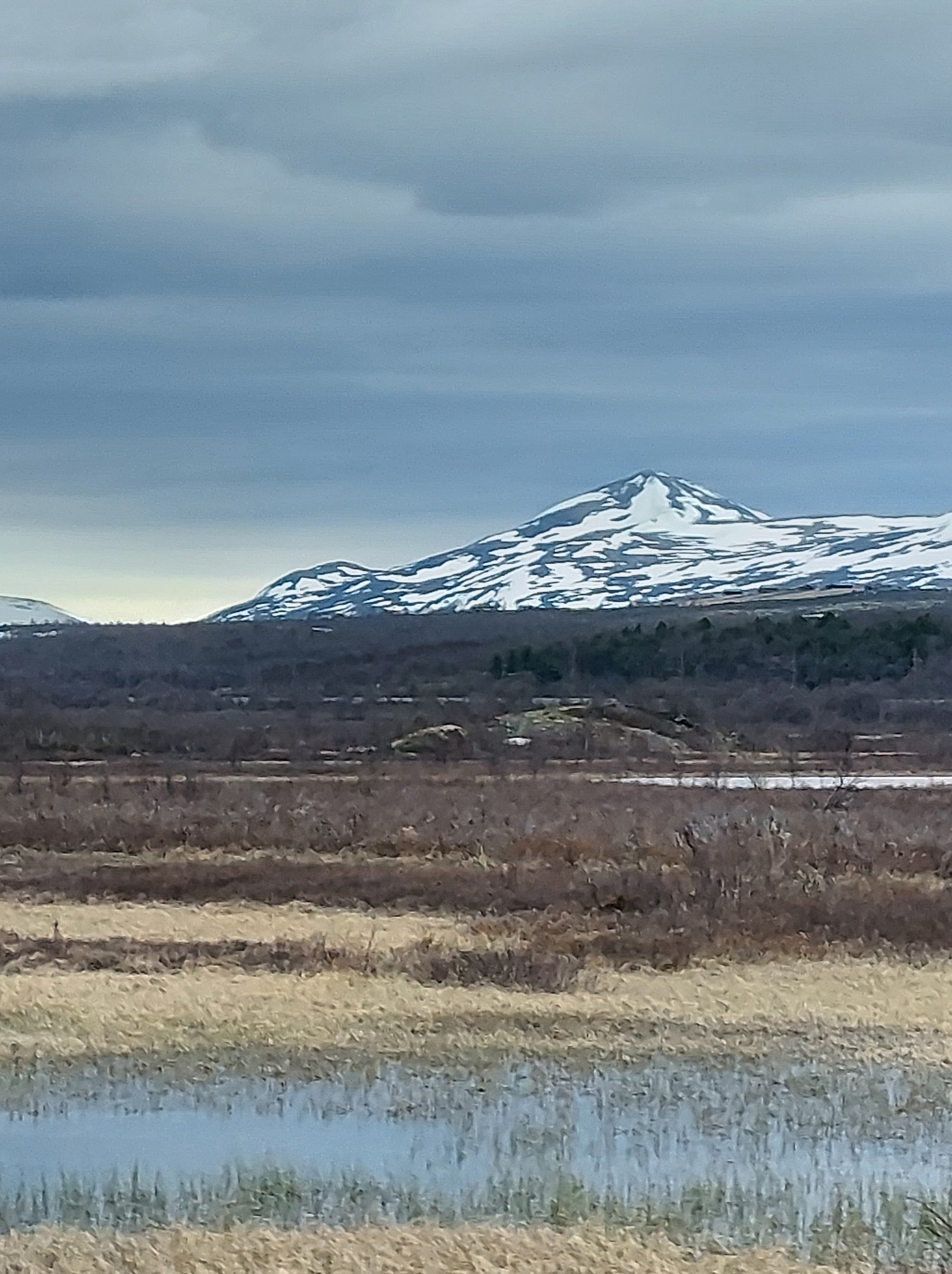
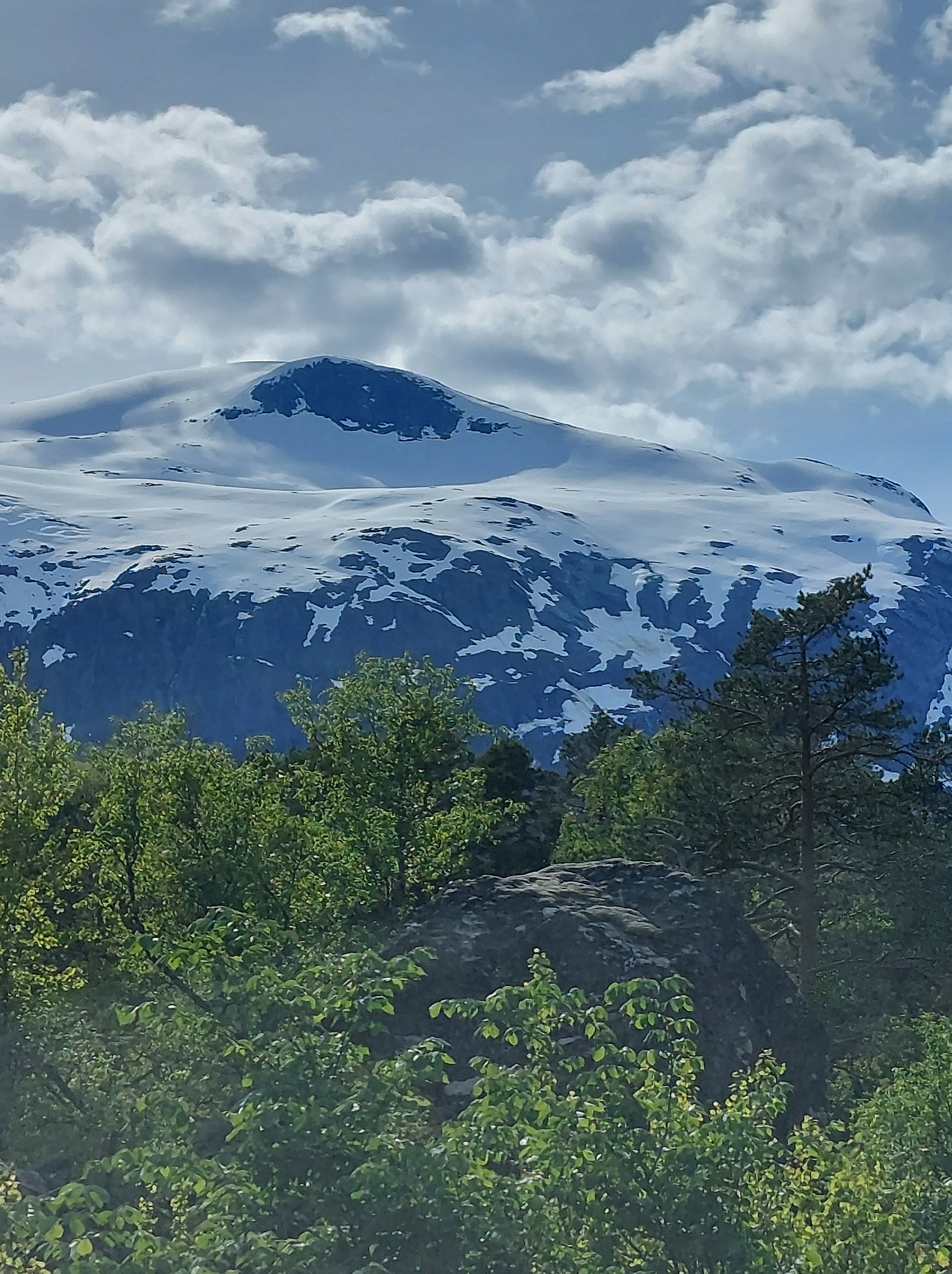
As we entered Rondane, the scenery changed dramatically the bright green gave way to rugged grey – brown. It felt like we had been transported to another planet. We were dazed, neither of us had expected such terrain, on driving further, we got our first glimpse of snow, it spotted the landscape in patches, if this got us animated, what was in store a little further afield was astounding, a smorgasbord of snow peaks. Some of these were affectionately named by us, one being “Vanilla Mint Dark Chocolate Chip” for its blend of white snow, dark brown earth and green tree cover another was naughtily named Mammy Poko Pants. Rondane is known for its distinctive geology and it was apparent why, the only other topography that I could say it bore resemblance to, from my experience, were the moors of Great Britain.
The Norwegian Scenic Routes are famous for the facilities that have been created along them for viewing the scenery and for their oft quirky toilets. Our first stop in Rondane was at the Sohlbergplassen viewpoint, we were lucky to have it all to ourselves. From here we could admire lake Atnsjøen circled by the peaks of Rondane, and learn their serious names. The sight was breath-taking, while writing this I realise that I am going to run out of superlatives to describe the beauty I am going to behold over the next 12 days.
Sohlbergplassen
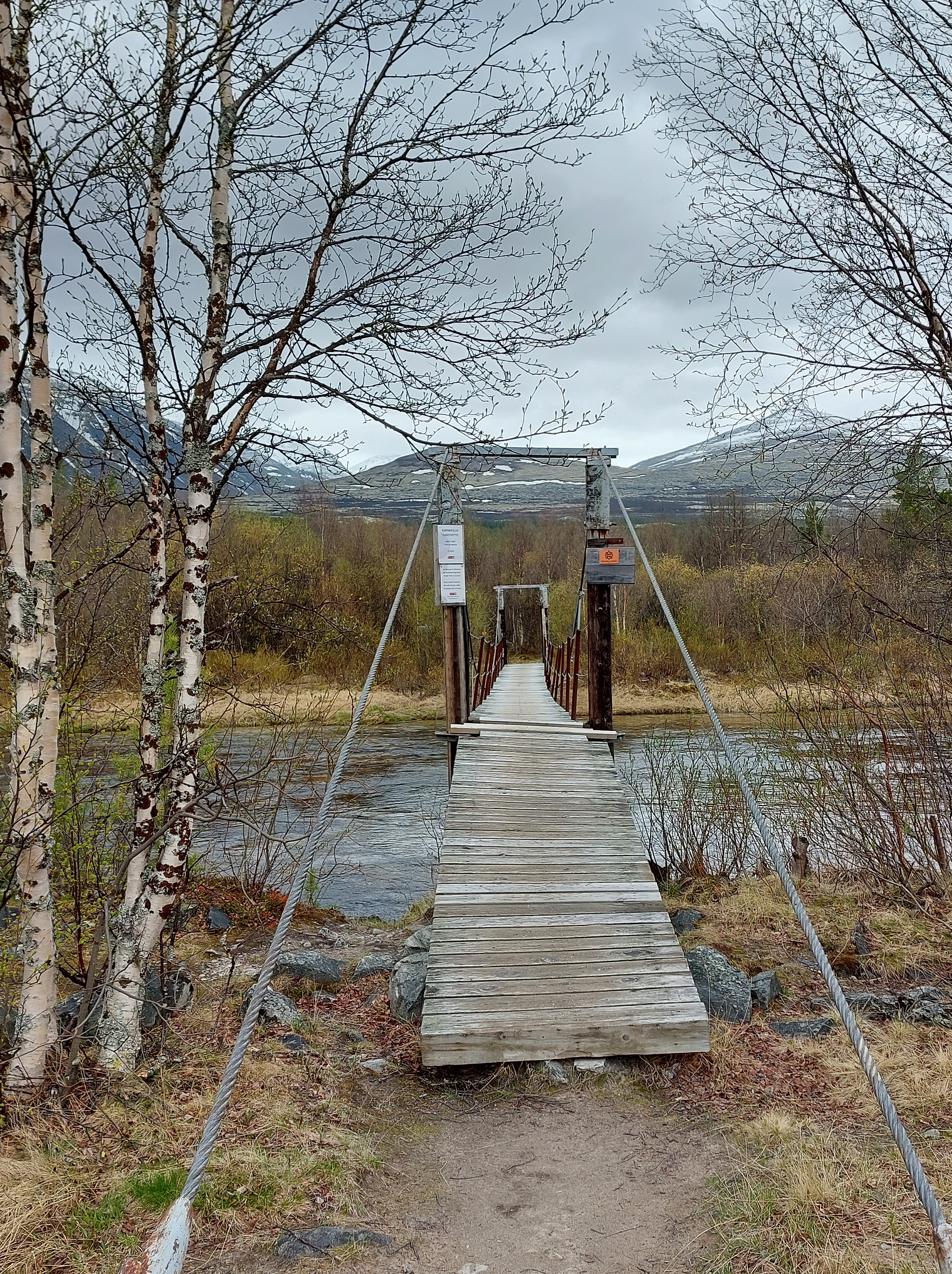
Our next stop was the viewpoint at Strombu, this, had a few people around, and the possibility of taking walks into the wilderness. It started raining as we crossed the wooden bridge across the Atna river, the earth was already soft and we still had a long way to go so we turned back rather than venture into the wild. We had the possibility of driving 12 kms east to see the Sollia stave church, but since we had a long drive ahead of us and would get plenty of opportunities to see stave churches, chose not to take this detour
We continued driving due north, dumbstruck by the landscape, till we reached Folldal, the village that I had identified for buying provisions for our next couple of days in our self-catering cabin. TomTom had other ideas for us and directed us to the Town Hall, rather than the Co-op supermarket we were trying to reach. We wandered around the building thinking that maybe it was behind the Town Hall, fortunately for us there was a mason working in a building adjacent to it and I hesitantly asked him where the supermarket was, doubting that he would speak English, I was wrong, he responded in stilted but passable English and gave us directions to the supermarket. I mention this episode to highlight that in Norway pretty much everyone speaks English, so language is not an issue for those that speak it.
The Town Hall, though closed had a clean toilet for public use, just as most villages and towns have, and a bank. We tried to get in, to exchange currency but could not, we would later learn that it is now next to impossible to conduct business at banks in Norway, phone and net banking being the only resource for this. There was an ATM so we withdrew some cash to have comfort.
We found the supermarket, conducted our purchases and as we came out of it, we asked a couple of charming ladies, grandmother and daughter, directions to a restaurant and in the process we landed having a lovely chit chat. They were off to their holiday cottage in the nearby hills. I am glad we met them on our first day, because the young lady counselled me that Norwegians may appear a bit lost in themselves, but they would love to engage with people and help them, so we should shake Norwegians out of their daze, when required. Her advice stood us in good stead.
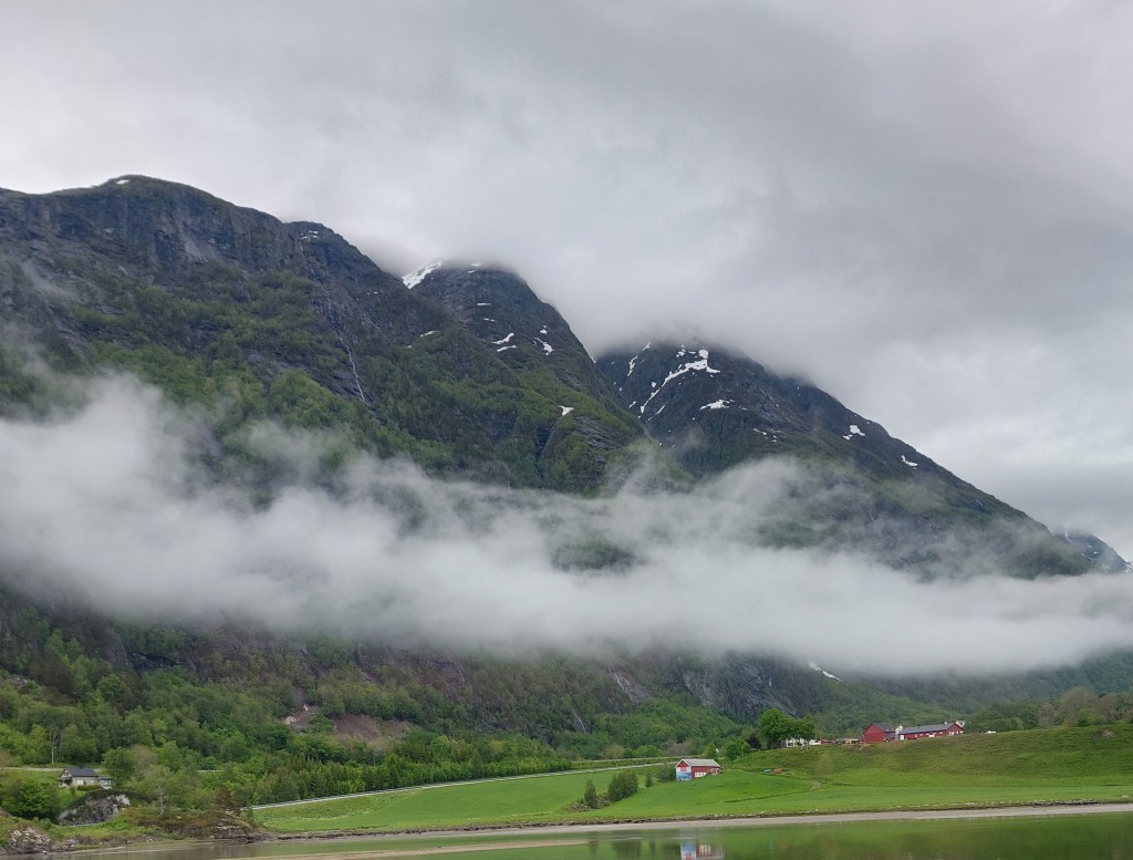
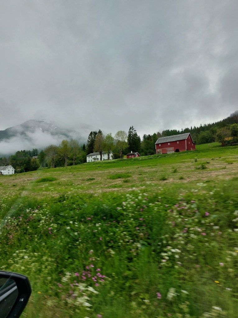
Folldal had its own set of activities to offer, such as walks and a visit to the mines by train in summer tourist season. The weather was still dull but it gave the mossy moorish landscape character, we decided that we could not bear to sit in a restaurant when we could dine alfresco, so we drove west of Folldal along R29 and on the edge of Dovre National Park, with its peaks as a backdrop sat down at a perfectly placed picnic table to assemble our sandwiches from the goodies we had just purchased. Weather was a good sport, it started splattering only as we were wrapping up.
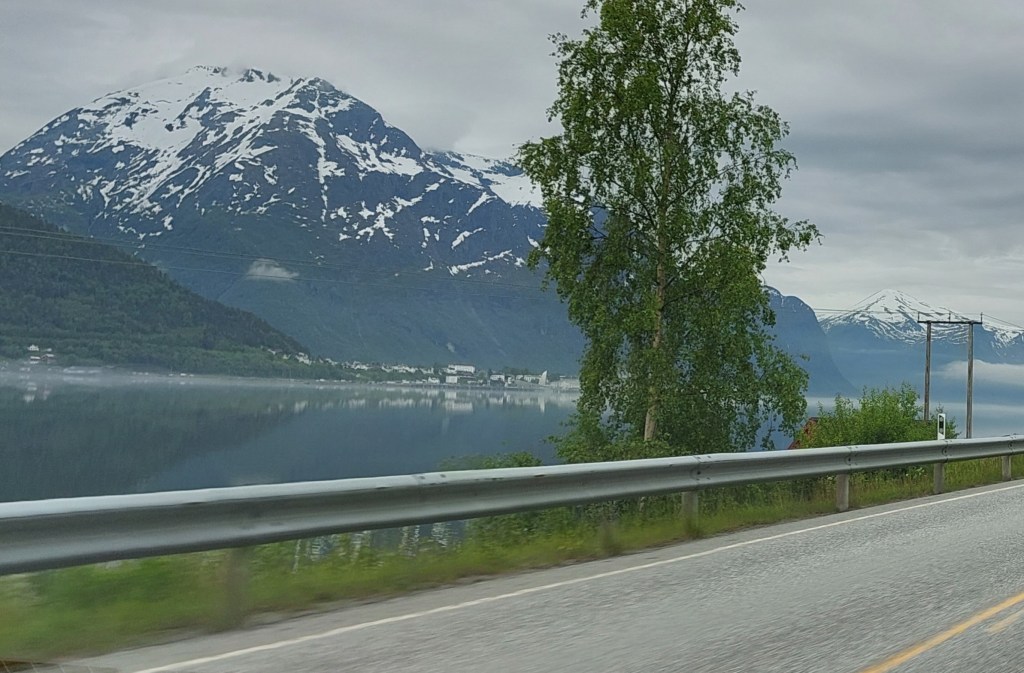
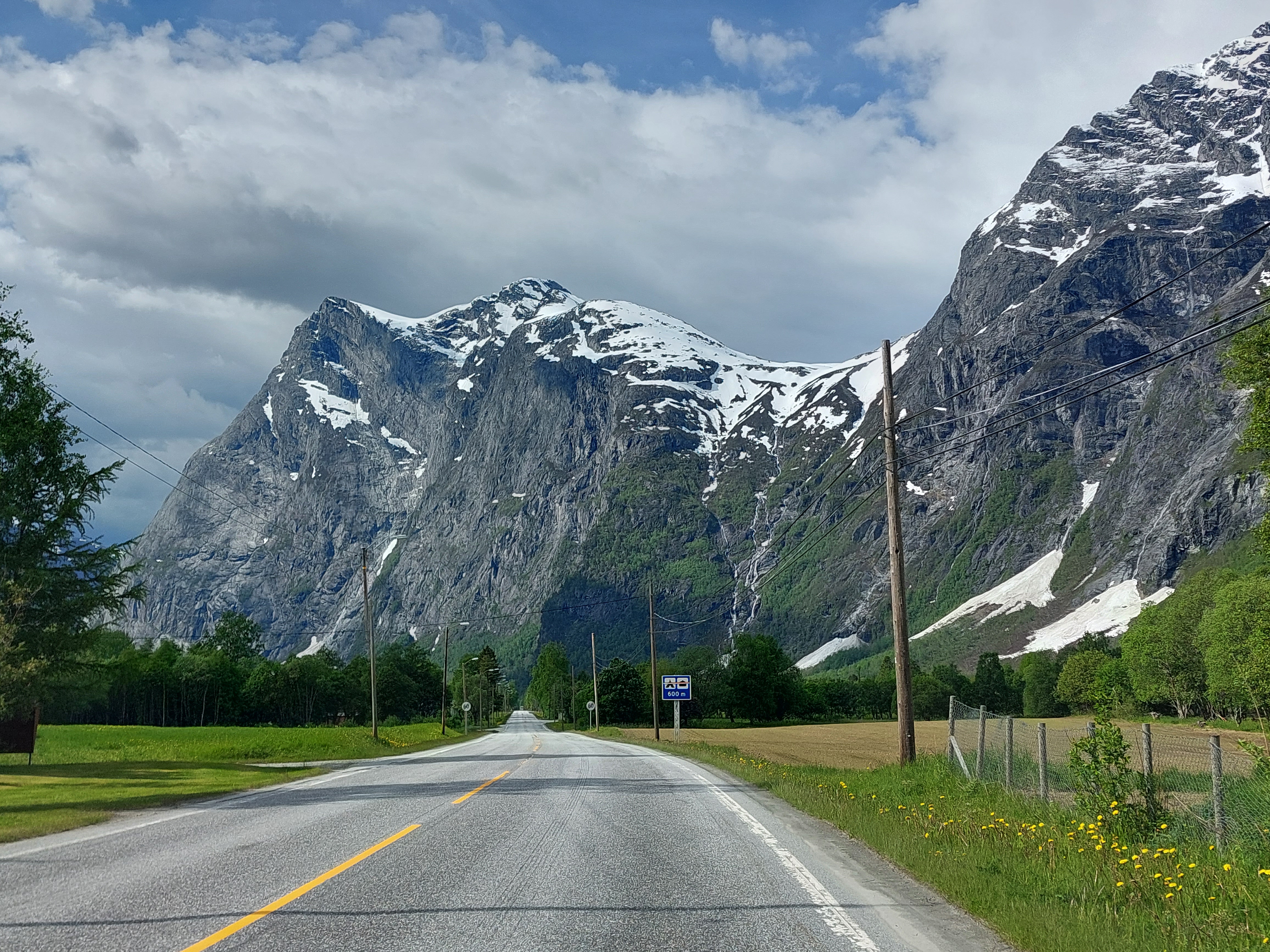
We eventually joined the E6 which we followed slightly south-west to the pretty mountain village of Dombås, the scenery changed at Dombas, the grey-brown gave way to lush green and yellow wild flowers lined the road. From Dombås we followed the E136 in the direction of Åndalsnes.
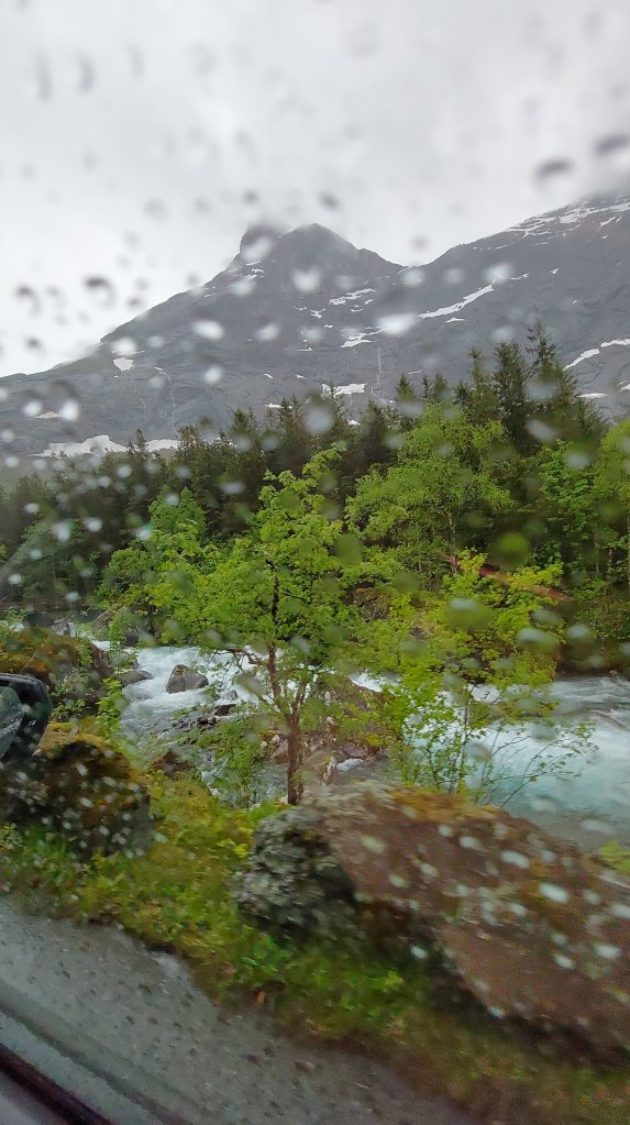
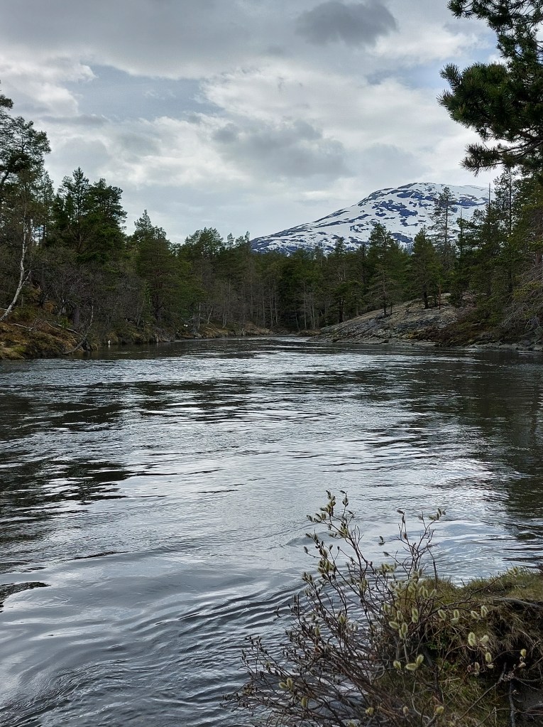
If Rondane had been other worldly the scenery from here was reminiscent of the Swiss Alps in summer. We were driving through the valley with pine covered slopes peppered with meadows and villages on either side of us, the peaks still snow clad and the clear blue Rauma river gurgling alongside and the railway track, for those who are not doing a road trip in Norway the scenic rail route from Dombås to Åndalsnes, the Rauma Line, is one of the must dos, for a taste of this stunning scenery and the most unforgettable waterfalls, there were thousands of waterfalls flowing into the valley, for us it was a never before seen sight.
There were plenty of places to stop, park and take a break in Møre og Romsdal the county which we had now entered, leaving behind Innlandet which we had been driving through since Oslo. You could wait to catch a glimpse of the train crossing one of the high mountain bridges or walk a little, to peek at a gorge at close range, we opted to pause by Rauma river at the rest place near Kvernhusfossen waterfall, run our hands through its icy waters and give my partner, the designated driver, a chance to feast his eyes on the nature fest.
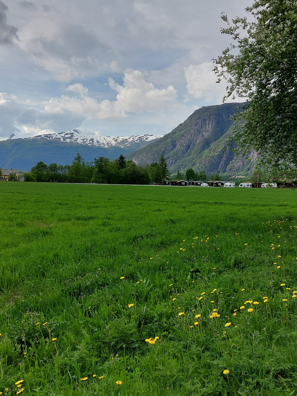
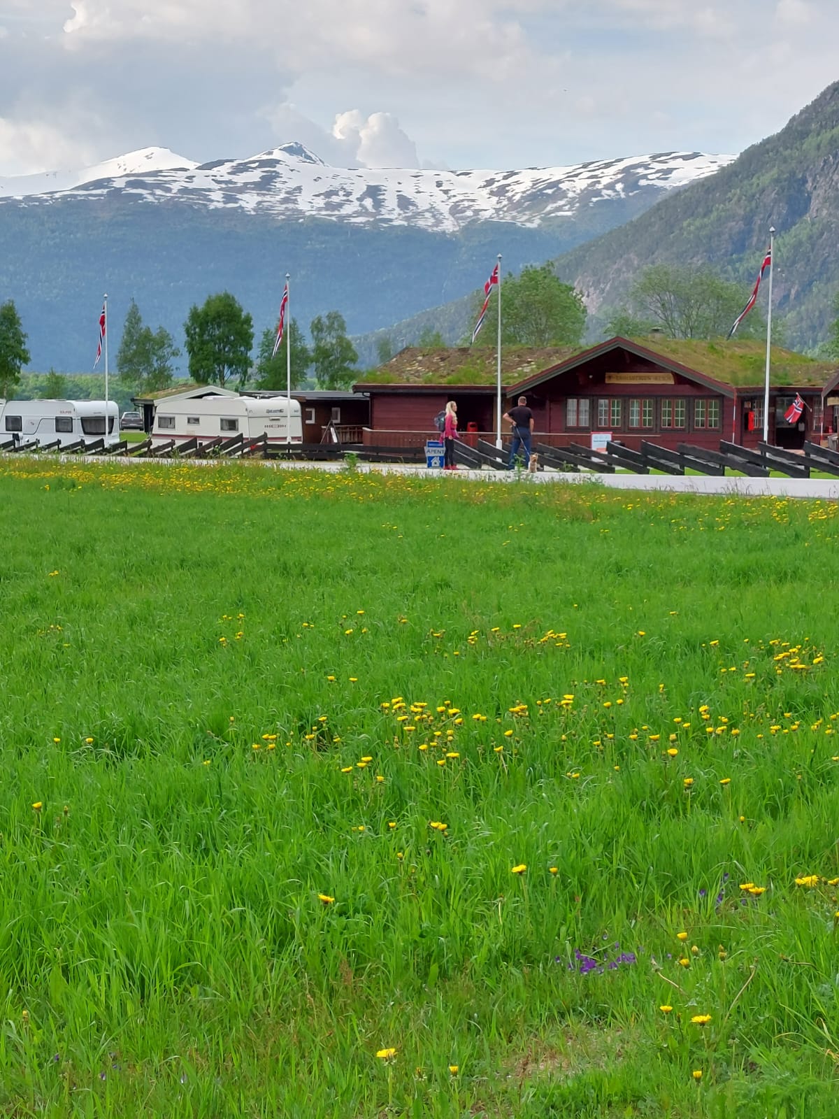
The sun was bright which made the colour of everything around us pop, we did the last stretch of about 40 kms without pause and reached our cabin at Trollstigen Resort by 5pm. The resort, which is more a camping, with places for camper vans, motorhomes and the like and a dozen or so cabins is on the out skirts of the town of Åndalsnes in a beautifully appointed valley surrounded by mountains, with the river flowing below it. We had chosen this resort as we had intended to drive Trollstigen (R63), literally Troll’s Ladder, or Trolls Road, the most famous National Scenic Route that turns off from here two days later, but, as luck would have it, avalanches during the winter had caused severe damage to the roads so the road was still closed.
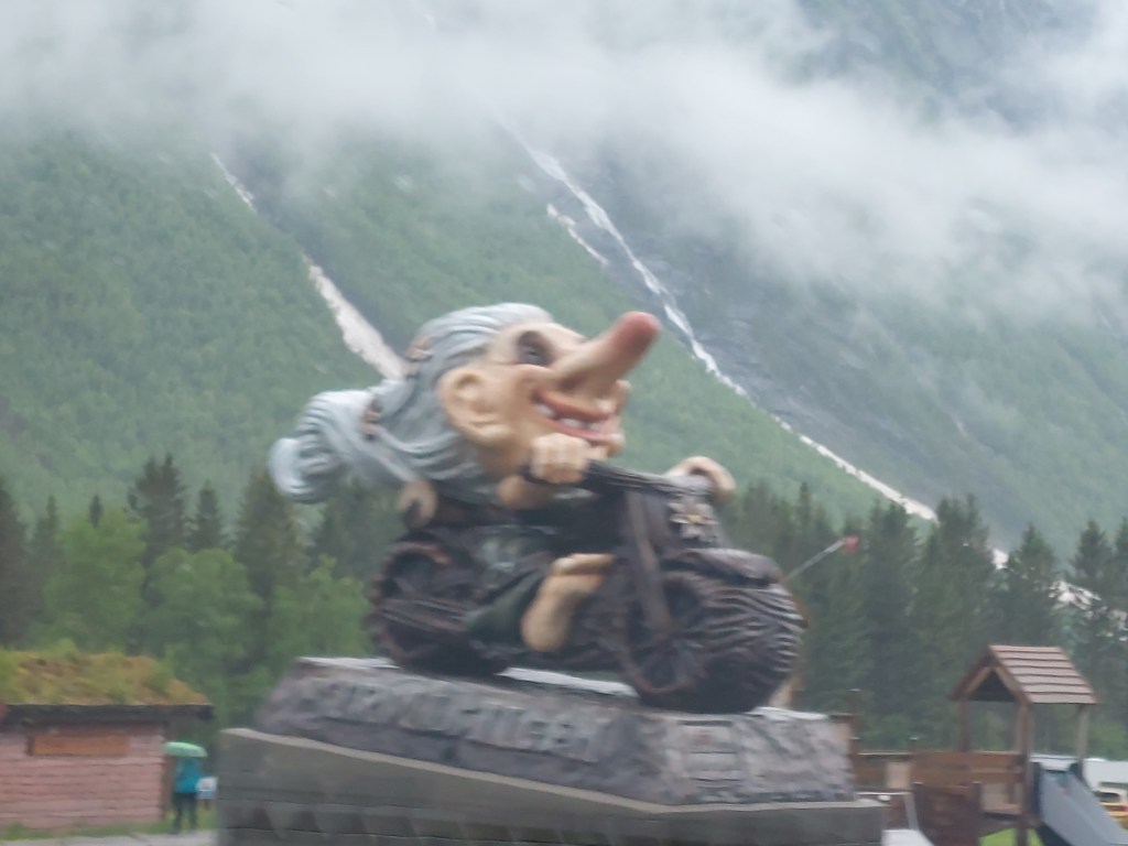
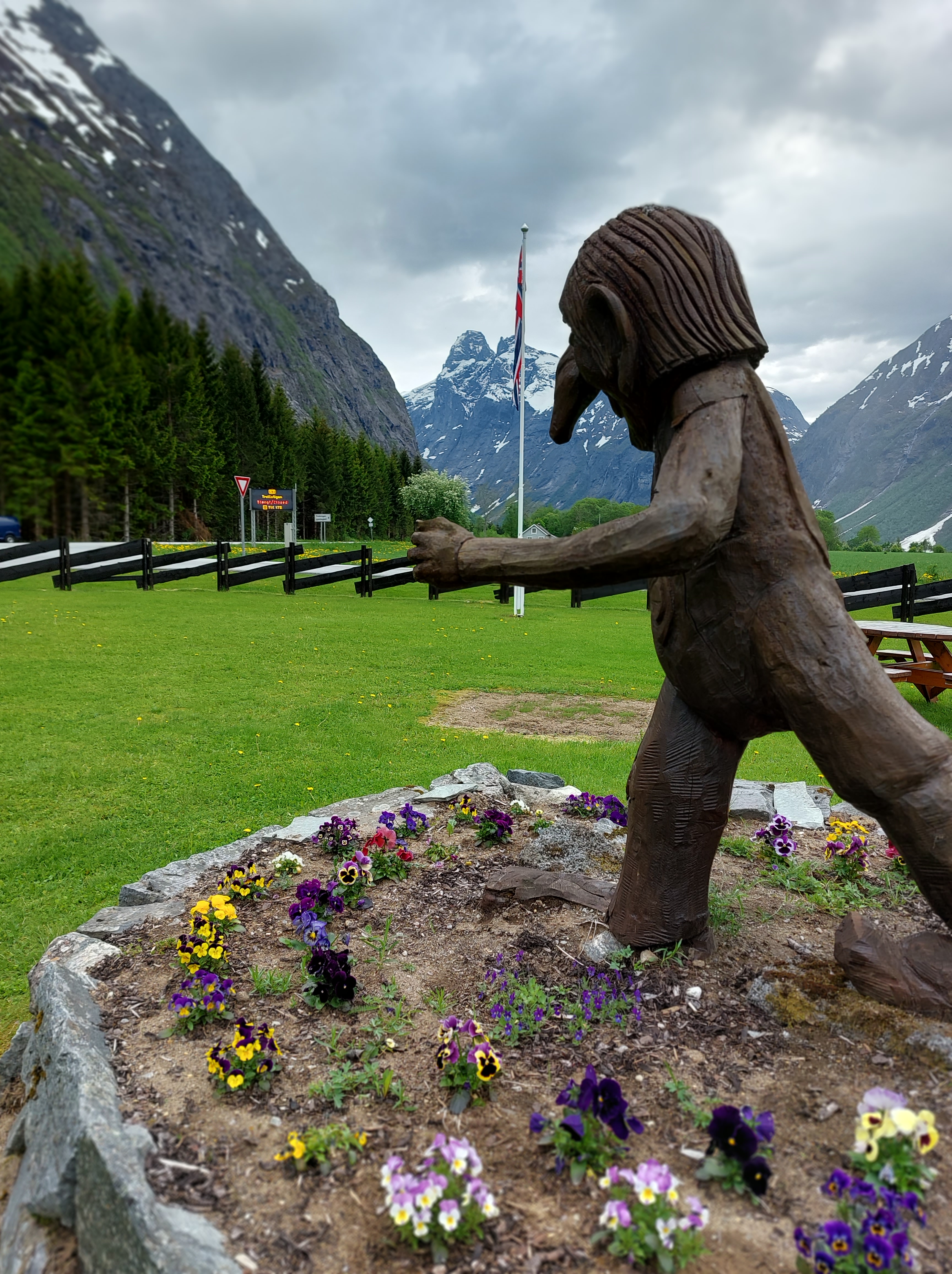
Social media has of course made the word troll a part of everyday parlance, but the original Trolls are ugly mythical creatures that are an indelible part of Scandinavian mythology, as per folklore mountain trolls live in the stony structures of Trollstigen and can be seen from time to time. As a result, Troll statues are ubiquitous in this area, our resort was no exception.
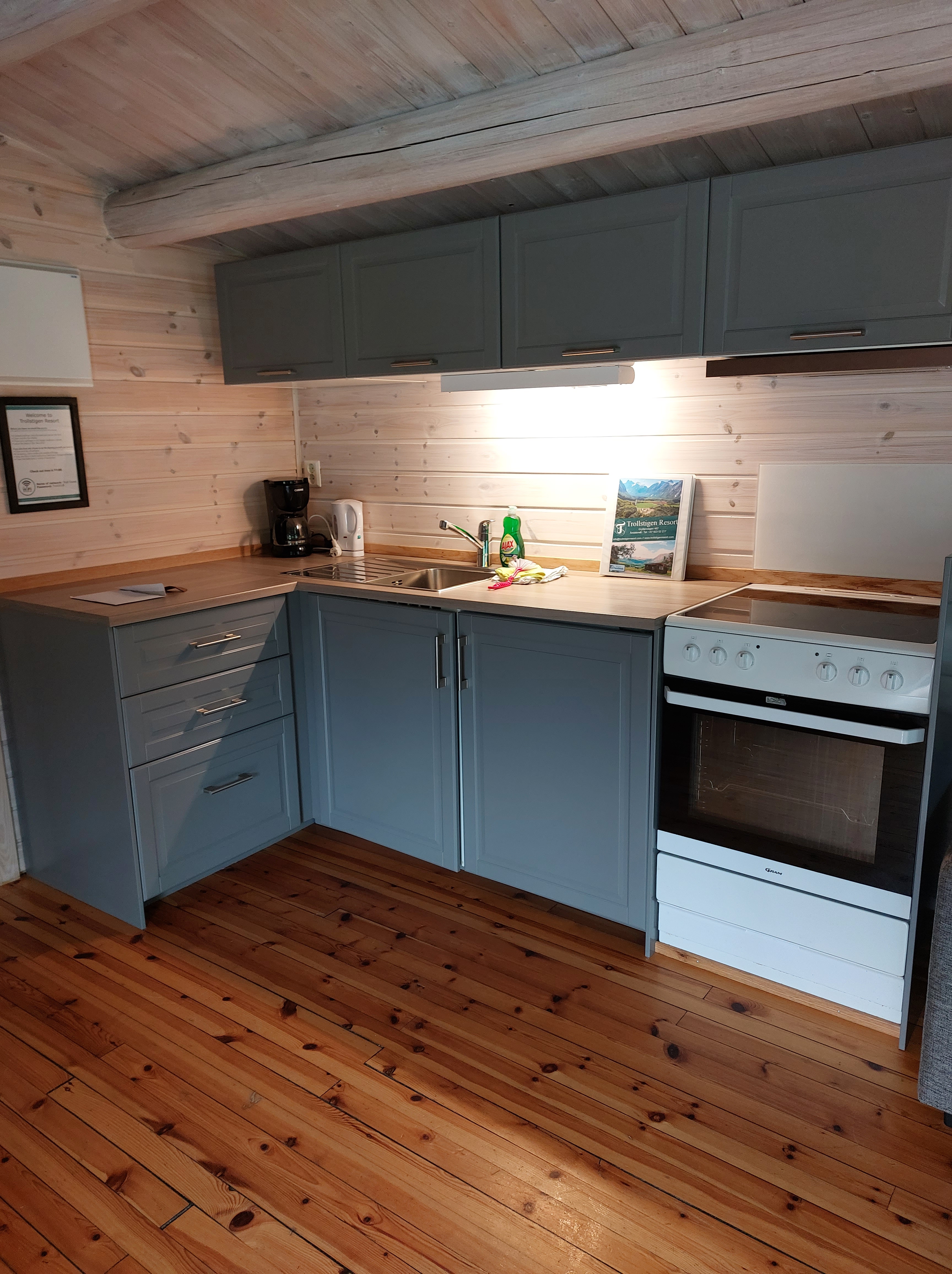
Our accommodation was a wooden cabin with two bedrooms that can sleep up to 8 persons, we had opted for one with a private bathroom, though we found that cabins with shared facilities (bathroom and kitchen), which are more economical, are quite popular. Nordic accommodations of this type, provide you linen at an extra charge, but what is worse is that you have to make your own bed. The bedrooms are always miniscule so I call this concept, by far the most irritating aspect of traveling in this part of the world, still small price to pay for access to such untouched beauty.
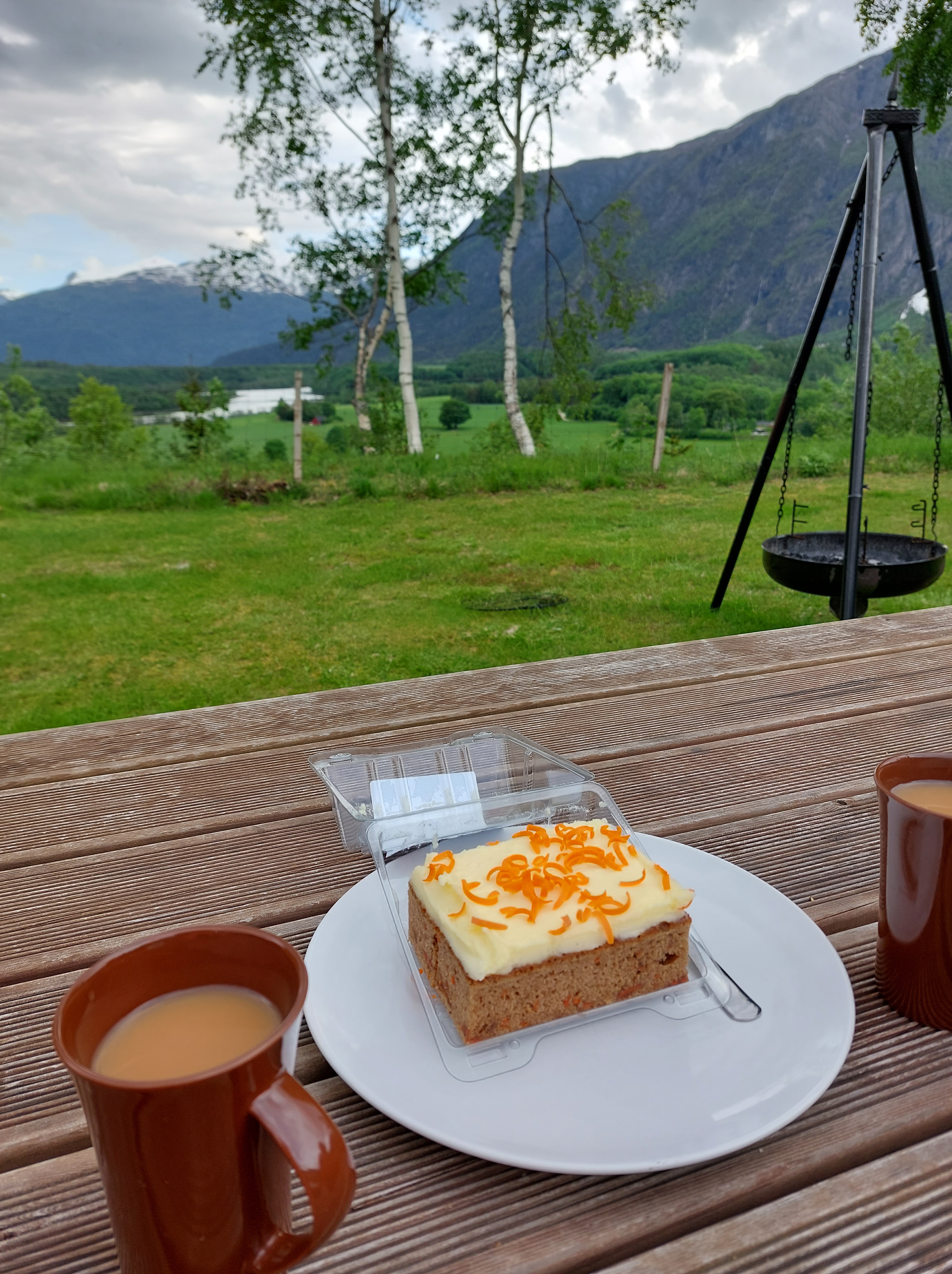
We had tea and cake sitting at our pretty picnic table overlooking the river and went off for a walk. On our way back we met another friendly Norwegian lady at the resort, who chatted with us about all things from Yoga to Karma and guided us to drive up the Trollstigen Road as far as it’s information viewpoint in the valley, it being accessible, even though the road ahead was closed, we decided to do this the next evening and retired to our cabin to put together our dinner and call it a night to be fresh for the next Norwegian magnum opus – the Atlantic Road, which I will write about in the next post.


